Disclosure : This site contains affiliate links to products. We may receive a commission for purchases made through these links.
Gallipoli (Major & Mrs Holt`s Battle Map)
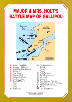
Gallipoli Peninsula and the Dardanelles in a series of Major & Mrs Holt’s Battle Maps showing the whole peninsula with three enlargements: the Cap Helles – Krithia area, the Suvla Plain, and the Anzac landing area on Z Beach. Present day road network is overprinted with extensive information on the battles there in 1915.On one side is an overview map of the whole peninsula with the southern coast of the Dardanelles at approx. 1:73,000, indicating the direction of attacking forces. On the reverse the three main areas: the Cap Helles ‘“ Krithia (Alcitepe) tip of the peninusla, the Suvla Plain, and the Anzac beaches are shown enlarged with greater detail. The maps indicate the final front lines, locations of forts, memorials, museums, cemeteries, preserved trenches, gun/battery remains, etc. Each enlargement has a separate location index and several more panels provide additional lists of war cemeteries, memorials, Ross Bastiaan marker plaques, Victoria Cross winners or literary figures and personalities buried or commemorated on the peninsula, etc.

Related Products:
 Gallipoli Campaign Map and Guide
 Walking Gallipoli
 Grasping Gallipoli: Terrain, Maps and Failure at the Dardanelles, 1915
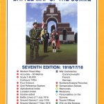 The Somme Major & Mrs Holt`s Battle Map
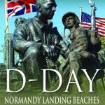
 The Normandy D-Day Landing Beaches Major & Mrs Holt`s Battle Map
 Market Garden Major & Mrs Holt`s Battle Map
 Guide To The Western Front SOUTH – Major Holt`s
 Major & Mrs Holt`s Definitive Battlefield Guide to the D-Day Normandy Landing Beaches: 75th Anniversary Edition with GPS References
 Glory: A Story of Gallipoli
 Battle of Verdun 1916 IGN Map
 Battle of the Somme 1916 IGN Map
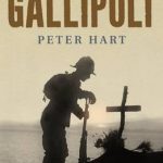 Gallipoli
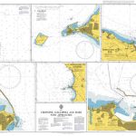 Admiralty Chart 140 – Crotone, Gallipoli and Bari with Approaches
 Major and Mrs Holt`s Battlefield Guide to Operation Market Garden
 Major & Mrs Holt`s Definitive Battlefield Guide Somme: 100th Anniversary
 Battle of the Bulge: St Vith
Verdun and the Battle for its Possession
Battle of the Bulge: St Vith
Verdun and the Battle for its Possession
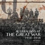 Australians at the Great War 1914-1918
 The Western Front: Battlefields, Memorials and Cemeteries of the First World War
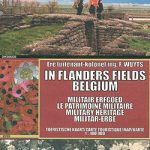 Belgium: In Flanders Fields
 Anzio Landings: Operation Shingle & the Battle for Rome Ed. Multigraphic Map
 The Somme Fir Tree Aerial Map
 Dunkirk: The History Behind the Major Motion Picture
 The Anzac Billy
 The Trench: Life and Death on the Western Front 1914 – 1918
 London Cemeteries : An Illustrated Guide and Gazateer
 The Last Battle: Endgame on the Western Front, 1918
 Battery Powered Moon Shaped Night Light
 The Normandy Battlefields: D-Day and the Bridgehead
 Erdogan Rising: The Battle for the Soul of Turkey
 Battle of Normandy Michelin Map
 199 Cemeteries to See Before You Die
 The Definitive Battlefield Guide to the D-Day Normandy Landing Beaches
Denmark Tourist Map – Major Cities with the Marguerite Route
BCM Cycling, Drinking and Eating Maps of Major Cities
The Definitive Battlefield Guide to the D-Day Normandy Landing Beaches
Denmark Tourist Map – Major Cities with the Marguerite Route
BCM Cycling, Drinking and Eating Maps of Major Cities
 Normandy `44: D-Day and the Battle for France
 War Memorials in Britain
Llantwit Major 1914
War Memorials in Britain
Llantwit Major 1914
 London`s Cemeteries
EQ6/HEQ5 Battery Pack
London`s Cemeteries
EQ6/HEQ5 Battery Pack