Disclosure : This site contains affiliate links to products. We may receive a commission for purchases made through these links.
Gallipoli Campaign Map and Guide
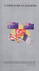
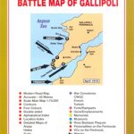
Detailed and very informative map of the Gallipoli Peninsula from Footstep Maps designed to show locations of the various landing sites, cemeteries and monuments of the Dardanelles Campaign during World War I. The map, prepared by its Australian publishers in cooperation with the Commonwealth Graves Commission, concentrates on highlighting sites particularly connected with the ANZAC forces, although many other locations are also marked.On one side is a present-day aerial photo of the Gallipoli Peninsula and the other side of the Dardanelles, overprinted with the sites (including monuments to the defending Turkish forces). Many of the accompanying notes are illustrated with colour photos.On the reverse the same area is shown with altitude colouring and relief shading to provide a better picture of the terrain. Front and trench lines from various stages of the war are marked. Very extensive notes, many with old historical photos, give more information on the background and various aspects of the campaign. Also included is a map showing Europe at the start for WWI.A small general map of the area around the Sea of Marmara shows road access to the Peninsula from Istanbul.


