Disclosure : This site contains affiliate links to products. We may receive a commission for purchases made through these links.
Categories
-
Best Sellers
-

Admiralty Chart SC5621_15 – Wexford and Rosslare – Rosslare Europort – Waterford
NEWAdmiralty Small Craft nautical charts comply with Safety of Life at Sea (SOLAS) regulations and are ideal for professional, commercial and recreational use. Charts within the Read More » -

Schrobenhausen L10
Schrobenhausen in a series of GPS compatible recreational editions of the Bavarian topographic survey at 1:25,000, with waymarked hiking trails and cycling routes, campsites and youth Read More » -

This is How We Do it: One Day in the Lives of Seven Kids from Around the World
This Is How We Do It follows the lives of seven REAL kids from Japan, Uganda, Russia, Iran, Peru, India and Italy for a single day. Read More » -

The Weekender: Copenhagen
Photographer Toby Mitchell is back with the latest instalment in `The Weekender` Series. And this time we are headed to Scandinavia and to the picturesque and Read More » -

Manchester & Salford – Oldham, Rochdale & Stockport OS Explorer Map 277 (paper)
Manchester, Salford, Oldham, Rochdale and Stockport area on a detailed topographic and GPS compatible map No. 277, paper version, from the Ordnance Survey’s 1:25,000 Explorer series.MOBILE Read More » -

Family Britain, 1951-1957
As in Austerity Britain, an astonishing array of vivid, intimate and unselfconscious voices drive this narrative. The keen-eyed Nella Last shops assiduously at Barrow Market as Read More » -

Admiralty Chart AUS157 – Geelong Harbour and Approaches
Admiralty standard nautical charts comply with Safety of Life at Sea (SOLAS) regulations and are ideal for professional, commercial and recreational use. Charts within the series Read More » -

Hello Hello
This gorgeous follow-up to the Caldecott Honor-winning They All Saw a Cat explores another aspect of seeing the world for young children. Beginning with two cats, Read More » -

Competa CNIG Topo 1040-4
Topographic coverage of mainland Spain at 1:25,000 published by the Centro Nacional de Informaciรณn Geograficรก, the country’s civilian survey organization. The maps have contours at 10m Read More » -
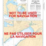
CHS Chart 3647 – Port San Juan and Nitinat Narrows
The official Canadian charts provide an excellent range of scales for the whole length of Canada`s coastline as well as the Grat Lakes and comply with Read More »
-


