Disclosure : This site contains affiliate links to products. We may receive a commission for purchases made through these links.
Future Mapping Company Monochrome Political World Wall Map PAPER
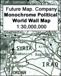
Monochrome political wall map of the world from the Future Mapping Company, size 129.5 x 71.5cm / 47.5″ x 28″ approx ‘“ paper version in glossy print on medium weight silk-finish paper, presenting the continents in white against the oceans in shades of grey, with a wide black border emphasizing the somber colour scheme. All place names are in their English versions. On land masses relief shading presents the topography, with names of main mountain ranges, peaks, rivers, etc, plus the network of main roads and railway lines. In the oceans shades of grey indicate the depth and the features of the sea floor, with names of ridges, basins, plateaux, etc. New Zealand and part of the Pacific are included on both sides of the map for better presentation of that region. The Polar Regions are shown on insets. The map is drawn on a Robinson projection, with latitude and longitude lines at 15ยฐ intervals, the International Date Line and clocks indicating variations from the GMT. This title is also available encapsulated for greater durability and any additional markings, plus magnetized and supplied with hanging strips, magnetic dots and pins.

Related Products:
 Future Mapping Company Monochrome Political World Wall Map MAGNETIC
 Future Mapping Company Monochrome Political World Wall Map ENCAPSULATED
 Future Map Company Commemorative Olympic World Wall Map PAPER
 Future Mapping Company Geological Wall Maps of the World
 Future Mapping Co. Sinu-Mollweide Political World Wall Map V.2: blue/emerald/pink/yellow PAPER
 World Future Mapping Geological Wall Map – Copper – Lemon – Pink – Jade – Tangerine PAPER
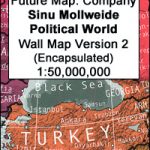
 World: Future Map Company Sinu-Mollweide Projection Political Wall Maps
 Future Map Company Commemorative Olympic Games World Wall Map ENCAPSULATED WITH HANGING-STRIPS
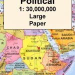
 World K+F Political 30M Wall Map LAMINATED
 Future Mapping Co. Sinu-Mollweide Political World Wall Map V.2: blue/emerald/pink/yellow ENCAPSULATED
 Future Mapping Co. Sinu-Mollweide Political World Wall Map V.1: gold/aqua/apple/khaki ENCAPSULATED
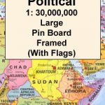
 World K+F Political 30M Wall Map MEDIUM PIN-BOARD
 World Global Mapping Antique Political Wall Map LARGE PAPER
 World Maps International Political Wall Map SMALL PAPER
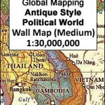
 World: Kรผmmerly + Frey Political Wall Maps
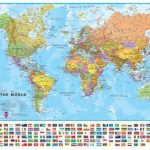
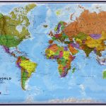
 World Maps International Political Wall Map LARGE PAPER
 World Maps International Political Wall Map MEDIUM PAPER
 World K+F Political 30M Map
 World Maps International Political Wall Map SMALL HANGING-STRIPS (with flags)
 World Maps International Political Wall Map LARGE HANGING-STRIPS (with flags)
 World Maps International Political Wall Map MEDIUM HANGING STRIPS (with flags)
 World Maps International Political Wall Map SMALL HANGING-STRIPS (without flags)
 World Maps International Political Wall Map LARGE HANGING-STRIPS (without flags)
 World Maps International Political Wall Map X-LARGE PAPER
 World Maps International Political Wall Map MEDIUM HANGING-STRIPS (without flags)
 World Global Mapping Political Wall Map LARGE PAPER
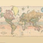 Stanford`s Library Map of the World (1879) – A3 Wall Map, Paper
 World Maps International Political UPSIDE-DOWN Wall Map LARGE PAPER
World: Michelin Political Wall Maps
World Global Mapping Political Wall Map MEDIUM PAPER
World Maps International Political UPSIDE-DOWN Wall Map LARGE PAPER
World: Michelin Political Wall Maps
World Global Mapping Political Wall Map MEDIUM PAPER
 World Michelin Wall Map PAPER
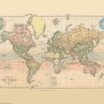 Stanford`s Library Map of the World (1879) – Original Size Wall Map, Paper
Stanford`s Library Map of the World (1879) – A2 Wall Map, Paper – Print on Demand
Stanford`s Library Map of the World (1879) – A1 Wall Map, Paper – Print on Demand
World Geological Wall Map LARGE, PAPER
Stanford`s Library Map of the World (1879) – Original Size Wall Map, Paper
Stanford`s Library Map of the World (1879) – A2 Wall Map, Paper – Print on Demand
Stanford`s Library Map of the World (1879) – A1 Wall Map, Paper – Print on Demand
World Geological Wall Map LARGE, PAPER
 World Maps International Political Wall Map SMALL PIN-BOARD FRAMED with flags
 World Political/Physical – Sea Relief F&B Wall Map LAMINATED with Metal Hanging Strips
 World K+F Physical 30M Wall Map MEDIUM MAGNETIC-BOARD
 World Maps International Political Wall Map LARGE PIN-BOARD FRAMED with flags
 World Maps International Political Wall Map MEDIUM PIN-BOARD FRAMED with flags