Disclosure : This site contains affiliate links to products. We may receive a commission for purchases made through these links.
Future Map Company Commemorative Olympic World Wall Map PAPER

World Commemorative Olympic Games Political Wall Map from the Future Mapping Company, size 101.5 x 59.5cm / 40″ x 23.5″ approx ‘“ paper version, printed in the colors of the five Olympic rings and highlighting the host cities from Athens in 1896 to Rio de Janeiro in 2016. Published to coincide with the 2012 Olympic Games, the map has pictograms of the 36 sports which featured in the London Olympics printed around its borders. This version is printed on high quality, medium weight silk-finish paper, and the map is also available encapsulated for greater durability and additional markings and supplied with hanging strips.All place names are in their English versions. Metallic and luminous versions of the five Olympic colours: blue, black, red, yellow and green represent different continents or regions of the world. Subtle relief shading shows the main mountain chains, with major rivers and names of some geographical regions (Sahara, Rocky Mountains, etc.). The maps also show the network of main roads and selected airports.Oceans, presented in shades of silver, indicate topography of the sea floor showing main ridges, fracture zones, etc., and include names of basins and plains. Two circular insets present Antarctica and the Polar Regions. Latitude and longitude lines, drawn in white at 15ยฐ intervals, clearly stand out against the background colouring. A series of clocks indicate the variation from the GMT.

Related Products:
 Future Map Company Commemorative Olympic Games World Wall Map ENCAPSULATED WITH HANGING-STRIPS
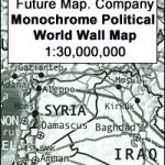 Future Mapping Company Monochrome Political World Wall Map PAPER
 Future Mapping Company Monochrome Political World Wall Map MAGNETIC
 Europe: Future Map Company Wall Map, Version 001 gold – khaki – yellow – sage PAPER
 Europe: Future Map Company Wall Map, Version 02 lemon – orange – thistle – khaki PAPER
 Future Mapping Company Monochrome Political World Wall Map ENCAPSULATED
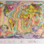
 Future Mapping Company Geological Wall Maps of the World
 World: Future Map Company Sinu-Mollweide Projection Political Wall Maps
 World Future Mapping Geological Wall Map – Copper – Lemon – Pink – Jade – Tangerine PAPER
 Future Mapping Co. Sinu-Mollweide Political World Wall Map V.2: blue/emerald/pink/yellow PAPER
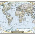 The World – The National Geographic 125th Anniversary Wall Map PAPER
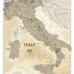
 Italy NGS Classic Wall Map PAPER
 World Global Mapping Antique Political Wall Map LARGE PAPER
 The Story of the Olympic Games: An Official Olympic Museum Publication
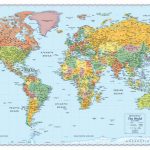 World Rand McNally Signature Wall Map PAPER
 World Rand McNally Classic Wall Map PAPER
World Geological Wall Map LARGE, PAPER
World Rand McNally Classic Wall Map PAPER
World Geological Wall Map LARGE, PAPER
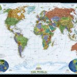 World NGS Decorator Wall Map PAPER
 Italy NGS Executive Wall Map PAPER
 World NGS Decorator Wall Map LARGE PAPER
 Colour The World F&B Wall Map
 Stanford`s General Map of the World (1920) – A3 Wall Map, Paper
Stanford`s General Map of the World (1920) – A2 Wall Map, Paper
Stanford`s General Map of the World (1920) – A3 Wall Map, Paper
Stanford`s General Map of the World (1920) – A2 Wall Map, Paper
 World NGS Classic Mural Wall Map 3-SHEET SET PAPER
 World Hemispheres NGS Wall Map PAPER
 World Political – Sea Relief F&B Wall Map LAMINATED
 World NGS Classic Wall Map PAPER
 Stanford`s Library Map of the World (1879) – A3 Wall Map, Paper
 Colour The World F&B Wall Map – with Metal Hanging Strips
 Stanford`s General Map of the World (1920) – XL Size (120 x 80cm) Wall Map, Paper
 World NGS Classic Wall Map LARGE PAPER
 World Global Mapping Political Wall Map LARGE PAPER
 Future Mapping Co. Sinu-Mollweide Political World Wall Map V.2: blue/emerald/pink/yellow ENCAPSULATED
 Future Mapping Co. Sinu-Mollweide Political World Wall Map V.1: gold/aqua/apple/khaki ENCAPSULATED
Stanford`s General Map of the World (1920) – A1 Wall Map, Paper – Print on Demand
Future Mapping Co. Sinu-Mollweide Political World Wall Map V.1: gold/aqua/apple/khaki ENCAPSULATED
Stanford`s General Map of the World (1920) – A1 Wall Map, Paper – Print on Demand
 World NGS Classic Wall Map POSTER-SIZE PAPER
 Stanford`s Library Map of the World (1879) – Original Size Wall Map, Paper
Stanford`s Library Map of the World (1879) – A2 Wall Map, Paper – Print on Demand
Stanford`s Library Map of the World (1879) – A1 Wall Map, Paper – Print on Demand
Stanford`s Library Map of the World (1879) – Original Size Wall Map, Paper
Stanford`s Library Map of the World (1879) – A2 Wall Map, Paper – Print on Demand
Stanford`s Library Map of the World (1879) – A1 Wall Map, Paper – Print on Demand
 World NGS Executive Mural Wall Map 3-SHEET SET PAPER