Disclosure : This site contains affiliate links to products. We may receive a commission for purchases made through these links.
Fulgoy
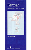
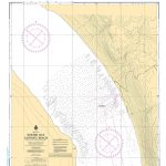
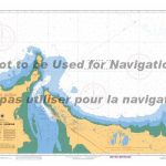
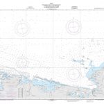
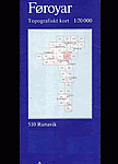
Topographic survey of Faroe Islands at 1:20,000 prepared by the Danish national mapping agency Kort og Matrikelstyrelsen. The islands’ topography is vividly presented by contours at 5 metre intervals, enhanced by relief shading plus colouring and/or graphics for different types of terrain or vegetation (scree, boulders, etc). The maps show all the detail expected of the topographic mapping at this scale and have a 1-km UTM grid, plus margin ticks for latitude and longitude at 1’ and 2` respectively. Map legend is in Danish only. The maps are available either separately or as sets of five of more sheets, each covering the main island group: Vagar, Sandoy, Suduroy, Nordoyar, Streymoy and Eysturoy.To see the list of all the titles in this series please click on the series link.

Related Products:
 Klaksvik
Hvannasund
Vidareidi
Tjornuvรญk
Slaettaratindur
Saksunardalur
Hvalvรญk
Gota
Vestmanna
Kollafjordur
Runavik
Nordradalur
Torshavn
Hestur
Nolsoyarfjodur
Sorvagur
Midvagur
Famara
Famjin
Hvalba
Sandur
Skopun
Gjogv
Sumba
Vagur
Tvoroyri
Hvalnes
Djupini
Mikladalur
Mjovanes
Svinoy
Litla Dimun
Stora Dimun
Faroe Islands: 20K Topographic Survey Maps
Vagar Island (5 map set – Nos. 110/209/210/309/310)
Sandoy Island (5 map set – Nos. 406/407/505/506/507)
Suduroy Island (7 map set – Nos. 402/403/404/501/502/503/504)
Nordoyar Island (8 map set – Nos. 511/512/513/611/612/613/712/713)
Streymoy Island (11 map set – Nos. 310/311/312/408/409/410/411/412/508/509/510)
Eysturoy Island (11 map set – Nos. 312/410/411/412/413/510/509/511/512/610/611)
Klaksvik
Hvannasund
Vidareidi
Tjornuvรญk
Slaettaratindur
Saksunardalur
Hvalvรญk
Gota
Vestmanna
Kollafjordur
Runavik
Nordradalur
Torshavn
Hestur
Nolsoyarfjodur
Sorvagur
Midvagur
Famara
Famjin
Hvalba
Sandur
Skopun
Gjogv
Sumba
Vagur
Tvoroyri
Hvalnes
Djupini
Mikladalur
Mjovanes
Svinoy
Litla Dimun
Stora Dimun
Faroe Islands: 20K Topographic Survey Maps
Vagar Island (5 map set – Nos. 110/209/210/309/310)
Sandoy Island (5 map set – Nos. 406/407/505/506/507)
Suduroy Island (7 map set – Nos. 402/403/404/501/502/503/504)
Nordoyar Island (8 map set – Nos. 511/512/513/611/612/613/712/713)
Streymoy Island (11 map set – Nos. 310/311/312/408/409/410/411/412/508/509/510)
Eysturoy Island (11 map set – Nos. 312/410/411/412/413/510/509/511/512/610/611)