Disclosure : This site contains affiliate links to products. We may receive a commission for purchases made through these links.
Fuerteventura Kompass 240
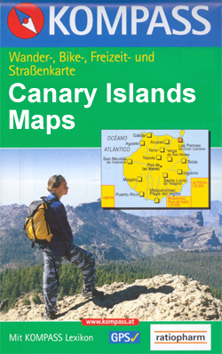
Fuerteventura ar 1:50,000 in a series of maps of the Canary Islands from Kompass, Europe’s leading publisher of detailed, contoured hiking maps. Excellent also for exploring each island on bike or by car, the maps highlight numerous hiking trails, indicating difficult sections, and show cycle routes. A wide range of symbols highlight various facilities and places of interest, including campsites and youth hostels, beaches, sport and leisure facilities, etc. The maps have a UTM grid for GPS users. Map legends included English. Street plans of main towns or holiday resorts are also provided.*In this title:* double-sided map, with most of the island on one side and the south-western part on the reverse. Contours are at 40m intervals. Local bus stops are shown. Street plans cover Corralejo, Costa Calma, Gran Tarajal, Morro Jable, Puerto del Rosario and Tarajalejo.*Please note:*The map comes with an illustrated booklet, in German only, describing the main sights. The booklet is not available in an English edition but the map itself has an English language legend, as mentioned above.

Related Products:
 Gran Canaria Kompass 237
 Tenerife Kompass 233
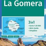 La Gomera Kompass 231
 Spain: Kompass Maps of the Canary Islands
 Spain: Kompass Maps of the Balearic Islands
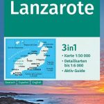 Lanzarote Kompass 241
 La Palma Kompass 232
 Ibiza – Formentera Kompass 239
 Sumatra – Medan Periplus Travel Map
 Northland: Whangarei, Bay of Islands and 61 Provincial Towns Pathfinder
 Italy: Kompass 25K/40K Hiking Maps of the Dolomites
 Renon / Ritten Kompass 068
 Istria Kompass 238
 Bolzano and Environs Kompass 54
 Merano Kompass 053
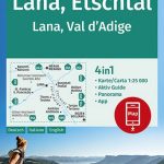 Lana – Etschtal / Val d`Adige Kompass 054
 Ausseerland – Ennstal – Tauplitz Kompass 68
Bressanone / Brixen and Environs Kompass 050
Ausseerland – Ennstal – Tauplitz Kompass 68
Bressanone / Brixen and Environs Kompass 050
 Sylt Kompass 701
Dolomiti di Brenta Kompass 073
Val di Sole – Madonna di Campiglio – Malรจ – Passo del Tonale Kompass 119
Adamello-Brenta Geopark NP Kompass 070
Val Badia / Gedertal Kompass 51
Sylt Kompass 701
Dolomiti di Brenta Kompass 073
Val di Sole – Madonna di Campiglio – Malรจ – Passo del Tonale Kompass 119
Adamello-Brenta Geopark NP Kompass 070
Val Badia / Gedertal Kompass 51
 Bornholm Kompass 236
 Lake Garda: Trento – Brescia – Verona 35K Kompass Hiking Atlas No. 2752
Vipiteno / Sterzing and Environs Kompass 058
Lake Garda: Trento – Brescia – Verona 35K Kompass Hiking Atlas No. 2752
Vipiteno / Sterzing and Environs Kompass 058
 Croatia – Montenegro Coast Cartographia 2-Map Set
Monti Sarentino / Sarntal Alps Kompass 056
Croatia – Montenegro Coast Cartographia 2-Map Set
Monti Sarentino / Sarntal Alps Kompass 056
 Val Gardena / Groden – Alpe di Siusi / Seiser Alm Kompass 076
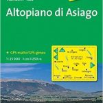 Altopiano di Asiago Kompass 623
 Bolzano and Environs Kompass 154
Val Passiria / Passeiertal Kompass 044
Bolzano and Environs Kompass 154
Val Passiria / Passeiertal Kompass 044
 Val di Funes / Villnรถsstal Kompass 627
 Malta – Gozo Kompass 235
 Regglberg – Latemar – Val d`Ega / Eggental Kompass 630
 San Gimignano – Volterra
Alta Val Venosta / Obervinschgau Kompass 041
San Gimignano – Volterra
Alta Val Venosta / Obervinschgau Kompass 041
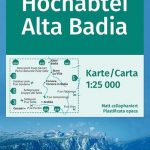 Alta Badia / Hochabtai Kompass 624
 Alta Pusteria / Hochpustertal Kompass 635
Monti de Valle Aurina / Ahrntaler Berge Kompass 082
Alta Pusteria / Hochpustertal Kompass 635
Monti de Valle Aurina / Ahrntaler Berge Kompass 082