Disclosure : This site contains affiliate links to products. We may receive a commission for purchases made through these links.
Fruลกka Gora National Park
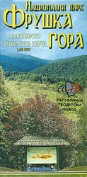
Fruลกka Gora National Park at 1:60,000 on a detailed contoured map from the Belgrade based Geokarta showing waymarked hiking trails, hotels and mountain huts, places of interest, etc. Coverage shows access to the park from Novi Sad on the northern side of the Danube.The map has contours at 10m intervals and shows the different protective zones within the park, including the hunting grounds. Waymarked footpaths are highlighted. Symbols indicate locations of the information centre, hotels and mountain hits, local churches and other interesting places, etc. All place names are in the Cyrillic alphabet only. The map has no geographical coordinates. Map legend includes English.On the reverse are extensive notes in Serbo-Croatian illustrated with colour photos.

Related Products:
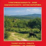
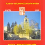 Bansko (with Pirin National Park)
 Galicica National Park
 Paklenica National Park
 Sredna Gora
 Mavrovo National Park
 Shivapuri Nagarjun National Park
 Dzukija National Park East
Dzukija I National Park West
Dzukija National Park East
Dzukija I National Park West
 Golija – Studenica Park and Biosphere Reserve
Aukstaitija National Park
Zemaitija National Park
Golija – Studenica Park and Biosphere Reserve
Aukstaitija National Park
Zemaitija National Park
 Ordesa and Monte Perdido National Park 2-Map Set Editorial Alpina
 Skadar Lake National Park
 Ordesa – Monte Perdido National Park Editorial Alpina 2-Map Set
 Ordesa and Monte Perdido National Park Editorial Alpina
 Bรฉarn – Aspe – Ossau – Pyrenees National Park Rando Editions 3
 Paklenica National Park Croatian Mountain Rescue Service 25K Map
 Kampinoski National Park
 Triglav National Park Kartografija WATERPROOF Hiking Map
 Thayatal National Park – Znaim – Retz – Gars am Karp Freytag & Berndt Map
 Pyhrn-Priel – Grรผnau – Almtal – Steyral – Kalkalpen National Park – Bad Aussee F&B WK081
 Berchtesgaden National Park – Watzmann Alpenverein KOMBI BY21
 Monti Sibillini National Park Edizioni Multigraphic 60/61
 Picos de Europa National Park 2-Map Set Editorial Alpina
 Lassen Volcanic National Park, CA
 Monti Sibillini National Park 6-Map Set
 Discover Cairngorms National Park
 Kootenay National Park Gem Trek Map
 Yosemite National Park Area
 Chitwan National Park
 Osogovski National Park
 Arusha National Park and Mt Meru
Great Smoky Mountains National Park, NC/TN
Arusha National Park and Mt Meru
Great Smoky Mountains National Park, NC/TN
 Triglav – Kranjska Gora – Bohinj
 Stelvio National Park Walking Guide – Italy`s Largest Alpine National Park
 Sareks National Park Lantmateriet BD10
 Vanoise National Park – Beaufortain Didier Richard 04
 รcrins Massif National Park Didier Richard 05
 MacGillycuddy`s Reeks and Killarney National Park OSI Adventure Map
 Banff National Park Gem Trek