Disclosure : This site contains affiliate links to products. We may receive a commission for purchases made through these links.
Friern Barnet and New Southgate 1898
Friern Barnet and New Southgate in 1898 in a fascinating series of reproductions of old Ordnance Survey plans in the Alan Godfrey Editions, ideal for anyone interested in the history of their neighbourhood or family. The map shows Friern Barnet on the left side and New Southgate on the right of the GNR railway that runs through it, including the large New Southgate station. The dominant feature is the massive Colney Hatch Asylum, the largest such institution in Europe when it opened in 1851. To its west of it is St John`s church, Southgate College, Colney Hatch village and Halliwick Manor House. The map extends northward to Brunswick Park, and southward to Bounds Green Farm. Other features include Arnos Grove Wood, Bowes Road, Pymmes Brook, Waterfall Hill, the Clock & Watchmakers Asylum, Friern Barnet Lane and Minchenden Wood. There are directories for Avenue Road, Friern Barnet Road and Oakleigh Road on the reverse.About the Alan Godfrey Editions of the 25″ OS Series:Selected towns in Great Britain and Ireland are covered by maps showing the extent of urban development in the last decades of the 19th and early 20th century. The plans have been taken from the Ordnance Survey mapping and reprinted at about 15 inches to one mile (1:4,340). On the reverse most maps have historical notes and many also include extracts from contemporary directories. Most maps cover about one mile (1.6kms) north/south, one and a half miles (2.4kms) across; adjoining sheets can be combined to provide wider coverage.FOR MORE INFORMATION AND A COMPLETE LIST OF ALL AVAILABLE TITLES PLEASE CLICK ON THE SERIES LINK.

Related Products:
 East Barnet & Southgate 1897 – 7.09
 Alexandra Park and South Friern 1935
 Alexandra Park & South Friern 1894 – 6a
 Alexandra Park & South Friern 1911 – 6b
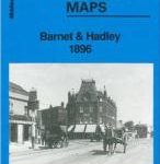 Barnet and Hadley 1896
New Barnet 1896
Barnet and Hadley 1896
New Barnet 1896
 Wallasey Village 1898
 Mill Hill Village 1898
 Darlington (South) 1898 – 55.10a
Newbury 1898 – 43.01
North London 1902-13 – 256
Darlington (South) 1898 – 55.10a
Newbury 1898 – 43.01
North London 1902-13 – 256
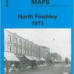 North Finchley 1911
North Finchley 1894
Eyemouth 1898 – 6.13
North Finchley 1911
North Finchley 1894
Eyemouth 1898 – 6.13
 Wealdstone and Hatch End 1935
Alston 1898
Bidston 1898
Annan 1898
Darlington West 1898
Duns & Greenlaw 1898 – 16.07
Oban 1898 – 98.07
Campbeltown 1898 – 257.08
Wealdstone and Hatch End 1935
Alston 1898
Bidston 1898
Annan 1898
Darlington West 1898
Duns & Greenlaw 1898 – 16.07
Oban 1898 – 98.07
Campbeltown 1898 – 257.08
 Falkirk 1898
 Barry 1898 – 50.04a
 Kidsgrove 1898
 Stoke upon Trent (South) 1898 – 18.05
Cockermouth 1898
Stoke upon Trent (South) 1898 – 18.05
Cockermouth 1898
 Darlington 1898 – 55.06a
Rock Ferry and New Ferry 1898
Keswick 1898
Darlington 1898 – 55.06a
Rock Ferry and New Ferry 1898
Keswick 1898
 Mid Finchley 1934
 Mid Finchley 1911
Nenthead 1898
Mid Finchley 1911
Nenthead 1898
 West Streatham & Tooting 1894 – 135a
 Newcastle-under-Lyme 1898 – 17.04b
 Oxford 1898 – 33.15
Bodmin 1906
South Oxford 1898 – 39.03
Oxford 1898 – 33.15
Bodmin 1906
South Oxford 1898 – 39.03
 Highgate 1894 – 19.2
 Highgate 1936 – 19.4