Disclosure : This site contains affiliate links to products. We may receive a commission for purchases made through these links.
Friendly Guides: Lizard Peninsula and Isles of Scilly Pocket Map Colletions
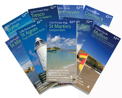
Lizard Peninsula and the Isles of Scilly in two sets of five detailed walking and cycling maps from Friendly Guides at 1:10,000 / 15,000 – printed on thick, waterproof paper. A collection of handy superscale maps ideal for anyone on a day-trip to explore this area of the West Country.All the maps in these sets come in a handy size measuring 59 x 21 cm, and they are double-sided to cover a wider area. Topography is indicated by different colourings for each type of terrain (sand, shingle, high or low cliffs, etc) and vegetation (woodlands, gorse, scrub, etc). Light overprints highlight footpaths and recommended walks; symbols show locations of campsites, pubs/cafes/restaurants, places of interest and ancient sites. The maps also feature lists of selected places to visit and recommended beaches. The maps do not feature a UTM grid (so it is not GPS compatible).

Related Products:
 Friendly Guides: Lizard Peninsula and Isles of Scilly walking maps
 Land`s End & Isles of Scilly – St Ives & Lizard Point OS Landranger 203
 Land`s End & Isles of Scilly – St Ives & Lizard Point OS Landranger 203 ACTIVE
 St Agnes – Western Rocks
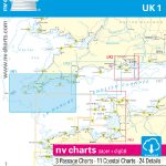 UK1 Isles of Scilly to Start Point – 2019/20 Edition
 Isles of Scilly OS Explorer Map 101 (paper)
 Isles of Scilly OS Explorer Active Map 101 (waterproof)
 The Lizard – Falmouth & Helston OS Explorer Map 103 (paper)
 The Lizard – Falmouth & Helston OS Explorer Active Map 103 (waterproof)
 Land`s End and Isles of Scilly 1900
 The Lizard 1894 – 359
 Lizard`s Tale
 The Lizard Beach Guide
 Lizard Point – Kynance – Cadgwith – Kennack Sands
 Dartmouth & Slapton Walking Map 25
 Isles of Scilly Map
 Cornwall: Chair Ladder & The Lizard Climbing Guide
 Admiralty Chart SC5603_12 – Isles of Scilly Saint Martin`s and the Eastern Isles
 Camino Guides: Pilgrim`s Guides to Camino de Santiago (The Way of St. James)
 Watchet & Quantock North Walking Map 55 – Kilve to Blue Anchor
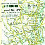 Sidmouth Walking Map 42
 Porlock Walking Map 02
 Isles of Scilly 1896
 Amalfitana – Sorrento Peninsula F&B Pocket Map
 Mortehoe & Woolacombe Walking Map 07
 Ilfracombe & Berrynarbor Walking Map 06
 Hartland & Clovelly Walking Map 11
 Salcombe & Hope Walking Map 20
 Prawle & Beesands Walking Map 24
 Ottery St Mary Walking Map 41
 Kingsbridge & Loddiswell Walking Map 23
 Croyde Walking Map 08 – Georgeham & Saunton
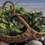 Wild Food Foraging in Cornwall and the Isles of Scilly
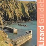 West Cornwall: The Lizard Guidebook: Helford, Coverack, Kynance, Mullion, Porthleven
 Horner & Dunkery Walking Map 03
 Bigbury, Avon & Erme Walking Map 22
 Beer – Branscombe – Seaton Walking Map 43
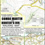 Combe Martin & Hunter`s Inn Walking Map 05
 Minehead – Dunster – Selworthy Walking Map 01
 Cornwall & The Isles Of Scilly