Disclosure : This site contains affiliate links to products. We may receive a commission for purchases made through these links.
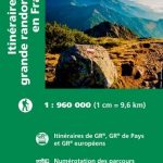
France: IGN Long-distance GR Routes Maps
Franceโ€s popular long-distance GR hiking routes presented by IGN on waterproof and tear-resistant maps with cartography from their highly popular TOP100 series. The route is prominently highlighted on contoured mapping at 1:100,000 and annotated with hiking distances. Symbols, both along the route itself and in the surrounding countryside, indicate refuges, gรฎtes-dโ€etape, sport and recreational facilities, cultural heritages, etc. Maps in this new series, begun by IGN in spring 2016, also provide a route profile, plus descriptions of important sights, many accompanied by colour photos. Map legend and the text include English. For GPS compatibility please see individual descriptions.The series also includes coverage of the Camino Francรฉs, the main route of the Way of St. James across northern Spain from Roncesvalles in the Pyrenees to Santiago de Compostela with mapping from Kompass Wanderkarte.

Related Products:
 France: Chamina Maps of Long-distance Mountain Bike Routes
 France Cycle Touring (8 long distance routes)
 Great Britain: Footprint Maps of Long-distance Hiking Routes
 Great Britain: Footprint Maps of Long-distance Cycling Routes
 Europe: Bikeline Map/Guides of Long-distance Cycling Routes
 France: FFRP Topo-guides to Long-distance Footpaths
 Germany and Alpine Regions of Europe: Kompass Maps of Long-distance Footpaths
 USA: Map Maps Long-Distance Cross-Country Touring Routes
 Spain: Editorial Alpina Maps of Long-distance Hiking Trails
 France: IGN 200K Tourist Maps
 France: Navicarte/Fluviacarte Guides to French Canals and Waterways
 Albania: Huber Verlag 50K Hiking and Cycling Maps
 Germany Long Distance Cycle Routes GERMAN
 France: IGN Hiking, Cycling & Other Recreational Maps
 France: Michelin Zoom Maps of Popular Holiday Areas
Italy: Tabacco 25K Maps of the Regional Parks in South Tyrol
France: Michelin Zoom Maps of Popular Holiday Areas
Italy: Tabacco 25K Maps of the Regional Parks in South Tyrol
 France: IGN Thematic Tourist Maps
 France: IGN 75K/25K TOP75 Recreational Maps
 France: IGN 150K Departmental Road Maps
 Romania: Bel Alpin Hiking Maps
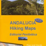 Spain: Ed. Penibetica Hiking Maps of Andalucia
 Cycling Northern France: Cycle Routes North of the Loire
 France: IGN Maps of Wine Growing Areas
 Chile: Trekkingchile Hiking and Exploration Maps
 Romania: Dimap Hiking Maps
 France: Rando Editions Coastal Tour of Brittany Cycling Atlases
 France: Didier Richard Hiking Maps of South Eastern France and Corsica
 Pohorje
 Great Britain & Ireland: Rucksack Readers` Guides to Long-distance Footpaths
 France Greenways and Cycle Routes IGN Map 924
 Julian Alps
 Discovery Walking Guides: Day Walks and Long Distance Guide Books
 Great Britain: National Trails and Other Long Distance Paths
Spain: CNIG Topographic Maps of Popular Scenic Areas
Great Britain: National Trails and Other Long Distance Paths
Spain: CNIG Topographic Maps of Popular Scenic Areas
 Italy: Ed. Abies Maps of Sardinia`s Trenino Verde Railway Routes
 France Long-Distance Footpaths (GRs) IGN 903
 Slovenia: Kartografija 40K Hiking and Cycling Sets
 Peaks of the Balkans Long-Distance Hiking Trail: Albania ‘“ Kosovo ‘“ Montenegro
 Slovenia: Kartografija 75K Hiking Maps
 Czech Republic: Kompass 50K Hiking Maps