Disclosure : This site contains affiliate links to products. We may receive a commission for purchases made through these links.
France: FFRP Topo-guides to Long-distance Footpaths
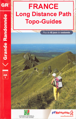
Light, high quality A5 paperback guides from the FFRP – the Fรฉdรฉration Franรงaise de la Randonnรฉe Pรฉdestre, to the long-distance GR hiking trails, with colour extracts from IGN`s 1:50,000 or 1:25,000 topographic survey maps overprinted with the route, plus a table indicating different facilities along the route, contact details for accommodation, etc.The GRs, Sentiers de Grande Randonnรฉe, form a dense network of footpaths across the French countryside, with several routes spanning the whole country. Particularly popular are the various pilgrim routes of the Way of St. James, the Alpine sections of the GR5, and the GR10 along the Pyrenees. Each topo-guide covers either one section of a longer path, a shorter connecting route, or a circular tour, as indicated by different colouring on our FFRP grid map for the whole series.The guides have colour extracts from IGN`s 1:50,000 and 1:25,000 topographic survey maps overprinted with the route. The descriptions of the route are divided into short sections according to the difficulty of the terrain, and are always placed next to the map extract for easy reference. ALL THE TEXT IS IN FRENCH but a large amount of information is conveyed by symbols. A table of all the main locations along the route indicates what facilities can be found there: public transport, food shops, and various types of accommodation (gรฎtes d`รฉtape, campsites, mountain refuges, hotels, etc.) with addresses and telephone numbers.HOW TO CHOOSE THE RIGHT REFERENCE NUMBER FROM THE FFRP GRID MAP: reference numbers of guides to the GR routes are shown in red boxes. A change in the colour of the route indicates a new guide, e.g. the GR10 along the Pyrenees is covered by four guides, Ref. Nos. from west to east 1086 (purple), 1091 (blue), 1090 (green) and 1092 (red).


