Disclosure : This site contains affiliate links to products. We may receive a commission for purchases made through these links.
France: Didier Richard Hiking Maps of South Eastern France and Corsica
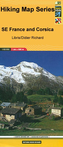
South-Eastern France including Corsica in a series of contoured and GPS compatible walking maps from Editions Didier Richard with a base derived from IGNโ€s topographic survey, highlighting both local hiking routes and the GR network of long-distance paths, gรฎtes and mountain refuges, interesting natural and cultural sites, etc. Most titles are at 1:60,000 to present a wider recreational area on one map.Relief is portrayed by contours at 50m intervals with additional hill shading and colouring for different types of vegetation. An overprint highlights local hiking trails, indicating routes which are part of the GR network. Bold symbols show gรฎtes and mountain refuges, climbing sites or via ferrata sections, mountain bike centres or other recreational locations, interesting cultural or natural sites, etc. The maps have a UTM grid. Map legend includes English. PLEASE NOTE: some of our customers may still remember the old Didier Richard series which provided a much wider coverage of south-eastern France. That series, occasionally still quoted in older walking guides, has now been out of print for well over a decade.

Related Products:
 Corsica South Didier Richard 09
 Corsica North Didier Richard 08
 รcrins Massif National Park Didier Richard 05
 Vercors Didier Richard
 Vanoise National Park – Beaufortain Didier Richard 04
 Queyras – Ubaye Didier Richard
 Monts d`Ardรจche Didier Richard
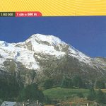
 Mont-Blanc – Annecy Didier Richard 02
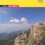
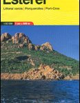 Maures – Esterel Didier Richard 15
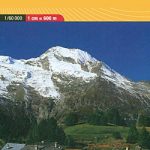
 Mont Blanc Pocket Map Edition Didier Richard
 France: IGN 75K/25K TOP75 Recreational Maps
 Mercantour & Alpi-Marittime Didier Richard 07
 France: Rando Editions/IGN 50K Walking Maps of the Pyrenees
 France: IGN Hiking, Cycling & Other Recreational Maps
France: IGN Maps of Environs of Main Cities
France: IGN Hiking, Cycling & Other Recreational Maps
France: IGN Maps of Environs of Main Cities
 Greece: Geopsis Hiking Maps of North-Eastern Greece
 Bulgaria: Domino Hiking Maps
 Italy: IGA 50K Hiking Maps of Central Italy
 Lake Geneva – Chablais – Faucigny
 Southern Provence: Marseille – Aix-en-Provence – Toulon
 Spain: Editorial Piolet Hiking Maps
France: IGN Long-distance GR Routes Maps
Spain: Editorial Piolet Hiking Maps
France: IGN Long-distance GR Routes Maps
 France: Rando Editions 50K Walking Maps of the French Alps
 Greece: Terrain Editions Maps for Hiking and Recreational Pursuits
 South Africa: 50K Hiking Maps of the Drakensberg Mountains
 Italy: Tabacco 25K Walking Maps of the Dolomites and North-Eastern Italy
South Africa: Slingsby Maps Hiking Maps of the Cape Peninsula
Italy: Tabacco 25K Walking Maps of the Dolomites and North-Eastern Italy
South Africa: Slingsby Maps Hiking Maps of the Cape Peninsula
 France: IGN 100K Top100 Road Maps of France
 Slovenia: Kartografija 75K Hiking Maps
 France: Kummerly + Frey Recreational Maps of the Vosges Mountains and Alsace
 Corsica South 3-Map Set Kompass 2251
 Romania: Bel Alpin Hiking Maps
 Italy: IGA 25K Hiking Maps of Central Italy
 Triglav Kartografija WATERPROOF Hiking Map
 Germany: Kรผmmerly+Frey Hiking and Recreational Maps
 Poland: Compass Hiking Maps
 France: IGN 25K TOP25/Sรฉrie Bleue Topographic Survey Maps
 Italy: L`Escursionista Editore 25K Hiking Maps of the Italian Alps
 Norway: Turkart 25K Topographic Hiking Maps