Disclosure : This site contains affiliate links to products. We may receive a commission for purchases made through these links.
France: Cruchley`s Map for Schools and Families c.1842 MEDIUM
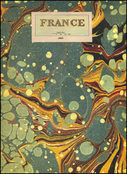
A cloth-backed reproduction from the Old Folding Maps of a map showing the division of France into dรฉpartments established during the French Revolution, made from an original engraved and published by G.F. Cruchley on 1st April 1841. Where possible, English names are used, e.g. Lower-, Upper-, and Eastern-Pyrenees, Mouth of the Rhone, Upper Alps, etc. Given the major administrative changes in Britain in 1974, it is interesting to note how relatively little has changed in France: the departments of the Petite Couronne and a few other adjustments.Each individual cloth-backed map is sold folded in a colourful case covered with a unique design marbled paper ‘“ no two cases are identical.PLEASE NOTE: to see the list of all the titles in this series from the Old Folding Maps please click on the series link.

Related Products:
 France: James Wyld`s Map of the French Provinces c.1844 MEDIUM
 Europe: Cruchley`s New Map of Europe c.1860 MEDIUM
 Spain and Portugal 1842 SMALL
 London: Cruchley`s 12 Miles Round London c.1826 MEDIUM
 Cruchley`s London 1832
Europe: Cruchley`s New Map of Europe c.1860 SMALL
Cruchley`s London 1832
Europe: Cruchley`s New Map of Europe c.1860 SMALL
 Africa: Gall & Inglis Map c.1854 MEDIUM
 London: Lewis` Topographical Dictionary Plan 1840 MEDIUM
 World Regions c. 1890 MEDIUM
 Bristol: Bartholomew`s Street Plan c.1870 MEDIUM
Russia c. 1895 MEDIUM
Bristol: Bartholomew`s Street Plan c.1870 MEDIUM
Russia c. 1895 MEDIUM
 World on Mercator`s Projection by James Wyld c.1861 MEDIUM
 Palestine or the Holy Land c.1818 MEDIUM
London: Rocque London c. 1741-5 MEDIUM
Palestine or the Holy Land c.1818 MEDIUM
London: Rocque London c. 1741-5 MEDIUM
 England and Wales: Brookes` Travelling Companion Map MEDIUM
 Europe: An Accurate Map of Europe in 1755 MEDIUM
 Italy: Stanfords Map of Italy 1859 MEDIUM
 Australian Colonies and New Zealand c.1874 MEDIUM
Paris: Plan de Paris c.1818 MEDIUM
Australian Colonies and New Zealand c.1874 MEDIUM
Paris: Plan de Paris c.1818 MEDIUM
 Paris: Plan de Paris et ses Fortifications c.1844 MEDIUM
 London: Urbium Londini et West Monasterii c.1736 MEDIUM
London: Cruchley`s 12 Miles Round London c.1826 SMALL
India c. 1835 MEDIUM
London: Urbium Londini et West Monasterii c.1736 MEDIUM
London: Cruchley`s 12 Miles Round London c.1826 SMALL
India c. 1835 MEDIUM
 China c. May, 1828 MEDIUM
Farther India MEDIUM
British Isles Geological MEDIUM
China c. May, 1828 MEDIUM
Farther India MEDIUM
British Isles Geological MEDIUM
 Africa c.1880 MEDIUM
Basin Of The Mediterranean Map MEDIUM
Australia c. 1895 MEDIUM
Africa c.1880 MEDIUM
Basin Of The Mediterranean Map MEDIUM
Australia c. 1895 MEDIUM
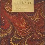 Ireland: A New Map by William Faden c.1797 MEDIUM
United Kingdom Steam Navigation Map MEDIUM
Ireland: A New Map by William Faden c.1797 MEDIUM
United Kingdom Steam Navigation Map MEDIUM
 London: A New Map of London by Robert Laurie & James Whittle c.1800 MEDIUM
London: Edward Mogg`s 24 Miles c. 1851 MEDIUM
London: Vicinity of London c.1847 MEDIUM
London: A New Map of London by Robert Laurie & James Whittle c.1800 MEDIUM
London: Edward Mogg`s 24 Miles c. 1851 MEDIUM
London: Vicinity of London c.1847 MEDIUM
 London: Robert Sayer`s London Directory Map 1792 MEDIUM
 London: Daniel Paterson`s 24 Miles Round London with Seats of Gentry and Nobility c.1791 MEDIUM
North Polar Chart 1902 MEDIUM
London: Froggets 30 miles round London MEDIUM
London: Daniel Paterson`s 24 Miles Round London with Seats of Gentry and Nobility c.1791 MEDIUM
North Polar Chart 1902 MEDIUM
London: Froggets 30 miles round London MEDIUM
 World: Stanfords Pacific Centred Map of the World 1884 SMALL
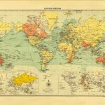 British Empire c.1895 MEDIUM