Disclosure : This site contains affiliate links to products. We may receive a commission for purchases made through these links.
France Collins Road Map 2021
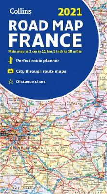
A fully revised and updated colour road map of France at 18 miles to 1 inch / 11km to 1cm (1:1,120,000). The map shows individual department by name. All cities, towns, roads, European route numbers, motorways and toll motorways are clearly shown, making it the ideal map for planning and route-finding.The map shows the road network in detail for easy route planning. With its political colouring of departments, it is ideal for reference and business users also.Main features* Fully revised and updated* Clear, detailed road network* Through-route maps of Paris, Lyon, Marseille, Strasbourg, and Toulouse* Distance chart giving distances in kilometres between main towns* Key to department names and numbers, and list of regions* Internet links to further information* Full Index to place names* Map key in English, French and GermanArea of coverageCovers the whole of France from the Belgian and German borders in the north to the Spanish border in the south, and from the Brest Peninsula in the west to the Italian and Swiss borders in the east. Also includes the island of Corsica.

Related Products:
 France Collins Road Map
 Europe Collins Road Map 2021
 Europe Collins Map Road
 Ireland Collins Road Map 2021
 Europe Collins Handy Road Atlas
 Britain and Ireland Collins Handy Road Atlas 2021 A5 SPIRAL-BOUND
 Scotland Collins Road Map 2023
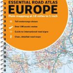
 Europe Collins Essential Road Atlas 2021 A4 SPIRAL-BOUND
Ireland Collins Road Map 2023
Europe Collins Essential Road Atlas 2021 A4 SPIRAL-BOUND
Ireland Collins Road Map 2023
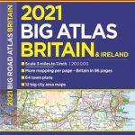
 Britain and Northern Ireland Collins Big Road Atlas 2021 A3 PAPERBACK
 France, Belgium & the Netherlands AA Road Map
 France North-West IGN Road Map
 Benelux – North France Michelin Road Atlas SPIRAL-BOUND
Britain and Ireland Collins Handy Road Atlas 2023 A5 SPIRAL-BOUND
Benelux – North France Michelin Road Atlas SPIRAL-BOUND
Britain and Ireland Collins Handy Road Atlas 2023 A5 SPIRAL-BOUND
 Britain Collins Road Map 2023
 Britain and Ireland Collins Handy Road Atlas 2022 A5 SPIRAL-BOUND
 France & Belgium Philip`s Road Map
 Britain and Northern Ireland Collins Essential Road Atlas 2021
 Britain & Ireland Philip`s Big Road Atlas 2021 A3 PAPERBACK
 France Michelin Tourist and Motoring Road Atlas 2021
 France IGN Mini Road Map
 Europe Collins Essential Road Atlas A4 SPIRAL-BOUND
 France & Spain Philip`s Road Atlas
 Scotland Collins Handy Road Atlas
 France South-East IGN Road Map 804
 France Marco Polo Road Atlas
 France 2021 Michelin Route Planning Map
 France South-West IGN Road Map 2020
 Britain & Ireland Philip`s Essential Road Atlas 2021 A4 PAPERBACK
 Britain and Northern Ireland Collins Big Road Atlas 2022 A3 SPIRAL-BOUND
 France F&B
 France North-East IGN Road Map 2020
 France Philip`s Navigator Road Atlas SPIRAL-BOUND
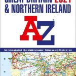 Great Britain & Northern Ireland A-Z Road Atlas 2021 A3 PAPERBACK
Poland ExpressMap Road Atlas 2020/2021
Britain and Northern Ireland Collins Big Road Atlas 2023 A3 PAPERBACK
Spain Road Atlas 2021 Set (incl. Map and DVD)
Great Britain & Northern Ireland A-Z Road Atlas 2021 A3 PAPERBACK
Poland ExpressMap Road Atlas 2020/2021
Britain and Northern Ireland Collins Big Road Atlas 2023 A3 PAPERBACK
Spain Road Atlas 2021 Set (incl. Map and DVD)
 Britain and Northern Ireland Collins Big Road Atlas 2022 A3 PAPERBACK
Britain and Northern Ireland Collins Big Road Atlas 2023 A3 SPIRAL-BOUND
Britain and Northern Ireland Collins Big Road Atlas 2022 A3 PAPERBACK
Britain and Northern Ireland Collins Big Road Atlas 2023 A3 SPIRAL-BOUND
 Poland ExpressMap Professional Users Road Atlas 2020/2021