Disclosure : This site contains affiliate links to products. We may receive a commission for purchases made through these links.
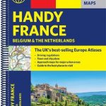
France, Belgium, Luxembourg and the Netherlands AA Glovebox Atlas

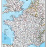
This handy atlas is presented in an A5 format ensuring that it can be stored easily, while the spiral binding provides flat folding pages. France is covered plus Belgium, the Netherlands and Luxembourg. Fully updated, with a clear scale, the atlas includes a regional map of France && city route maps of Amsterdam, Bruxelles, Luxembourg and Paris, plus a route-planning map for easy journey planning. A channel crossing ferries maps shows ferry routes with operators. Significant places of interest are shown on the main map with over 5,000 features located.

Related Products:
 France, Belgium & the Netherlands Philip`s Road Atlas
 Belgium – Netherlands – Luxembourg Marco Polo Road Atlas
 The Ultimate Netherlands, Belgium & Luxembourg Cycle Route Planner
 Belgium – Luxembourg
 France, Belgium & the Netherlands AA Road Map
 Belgium – Luxembourg 2021 Michelin
 Scotland AA Glovebox Atlas
 France Michelin Tourist and Motoring Atlas 2022 SPIRAL-BOUND
Belgium & Luxembourg Michelin 716
Poland: Carta Blanca/Kompas Road Atlas 2015 GLOVEBOX, SPIRAL-BOUND
France Michelin Tourist and Motoring Atlas 2022 SPIRAL-BOUND
Belgium & Luxembourg Michelin 716
Poland: Carta Blanca/Kompas Road Atlas 2015 GLOVEBOX, SPIRAL-BOUND
 France, Belgium and Netherlands NGS Classic Wall Map LAMINATED
 France, Belgium and Netherlands NGS Classic Wall Map PAPER
 France, Belgium and Netherlands NGS Executive Wall Map PAPER
 France & Spain Philip`s Road Atlas
 France Michelin Pro Atlas 2021 A4 PAPERBACK
 France Michelin Pro Atlas 2020 A4 PAPERBACK
 France, Belgium and Netherlands NGS Executive Wall Map ENCAPSULATED
 The Ardennes Walking Guide – Belgium, Luxembourg and the Ardennes
France Michelin Road Atlas 2022 SPIRAL-BOUND TEAR-RESISTANT
The Ardennes Walking Guide – Belgium, Luxembourg and the Ardennes
France Michelin Road Atlas 2022 SPIRAL-BOUND TEAR-RESISTANT
 Belgium – Luxembourg Marco Polo Map
 Belgium & Luxembourg ITMB
 France Michelin Tourist and Motoring Road Atlas 2021
 France Michelin Mini Road Atlas
 National Geographic France Belgium and the Netherlands – Published 1960
 Belgium – Luxembourg Hallwag Road Map
 Finland Road Atlas GLOVEBOX, SPIRAL-BOUND
 France Marco Polo Road Atlas
 France Michelin Tourist & Motoring Atlas 2021 MULTIFLEX
 France Philip`s Navigator Road Atlas SPIRAL-BOUND
 Netherlands & Belgium ITMB
Belgium & Luxembourg c.1900
France Michelin Camping Car Atlas A4 SPIRAL-BOUND
Netherlands & Belgium ITMB
Belgium & Luxembourg c.1900
France Michelin Camping Car Atlas A4 SPIRAL-BOUND
 Europe Collins Handy Road Atlas
 Lonely Planet Belgium & Luxembourg
 Luxembourg Michelin
 DK Eyewitness Travel Guide Belgium & Luxembourg
 France Collins Road Map
 France Michelin Booklet Atlas
 The Rough Guide to Belgium and Luxembourg
 France & Belgium Philip`s Road Map