Disclosure : This site contains affiliate links to products. We may receive a commission for purchases made through these links.
France Administrative Departments Michelin
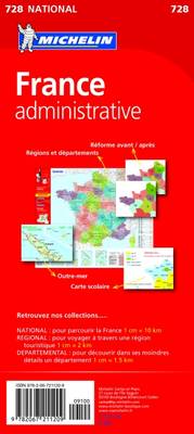
New (post 1.1.2016) administrative regions of France presented at 1:1,700,000 on a map from Michelin. Within each region colouring also indicates the division into dรฉpartments, shown with their official numbers. Town symbols indicate administrative status of each location. The map also shows the network national and regional roads.Additional insets and information panels provide: for comparison, maps showing the division of France into regions before and after 1.1.2016; an alphabetical list of the regions showing surface area and population of their constituent dรฉpartment; maps of France’s overseas dรฉpartments and territories (DOM-TOMs); a map showing school zones from 1.1.2016; a distance/driving times table for 26 cities; notes on the administrative structure of the country (regions, dรฉpartments, arrondisements, cantons and communes); plus an enlargement of the area around Paris. All the text is in French only.PLEASE NOTE: as of March 2016, six regions have a temporary name: Alsace-Champagne-Ardenne-Lorraine, Aquitaine-Limousin-Poitou-Charentes, Auvergne-Rhรดne-Alpes, Bourgogne-Franche-Comtรฉ, Languedoc-Roussillon-Midi-Pyrรฉnรฉes, and Nord-Pas-de-Calais-Picardie. Regions must make a decision about their name before 1 July 2016 and a final decree will announced on 1 October 2016.

Related Products:
 France IGN Administrative Wall Map
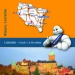
 Alsace – Lorraine – Champagne Michelin Green Guide
 Grand Est Michelin Maxi Regional 601
 Alsace – Lorraine Michelin Regional 516
 France: Cruchley`s Map for Schools and Families c.1842 MEDIUM
 Grand Est – Massif des Vosges – Alsace-Lorraine IGN Regional NR05 DOUBLE-SIDED
 Champagne-Ardenne Michelin Regional 515
 France: Michelin 200K Regional Road Maps
 France Northeast Michelin
 Battle of Alsace Michelin Map
 France, Belgium and Netherlands NGS Classic Wall Map PAPER
 Wine Regions of France Michelin Guide
 Champagne – Ardenne Guide Vert Michelin – FRENCH Edition
 Wine Regions of France Michelin Green Guide
 France, Belgium and Netherlands NGS Classic Wall Map LAMINATED
 France, Belgium and Netherlands NGS Executive Wall Map PAPER
 Ile-de-France Ign Regional NR03
 France: Michelin 500K Road Maps
 Hauts-de-France IGN Regional NR01
 France Michelin Booklet Atlas
 France, Belgium and Netherlands NGS Executive Wall Map ENCAPSULATED
 France Southwest Michelin
 Germany Administrative F&B Wall Map
 France Michelin Wall Map ENCAPSULATED
 Central France Michelin Regional 518
 France: Michelin 150K Local Road Maps
 France: IGN 350K Touring Maps (2016 editions)
 Discover France: The Big Travel Book
 France Principal Grape Varieties
 France: Michelin Centenary “Hier – Aujourd`hui” Map-Packs
 Bas-Rhin – Haut-Rhin – Territoire de Belfort Michelin Local 315
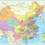
 China Administrative Gizi Map
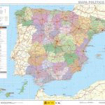
 Spain: CNIG Road Maps of Autonomous Administrative Regions
 Switzerland K+F Administrative Map
 Aisne – Ardennes – Marne Michelin Local 306
 France Principal Grape Varieties Wall Map
France 2022 Michelin Reversible 722
France Principal Grape Varieties Wall Map
France 2022 Michelin Reversible 722
 France 2021 Michelin Reversible
 Spain CNIG Administrative Wall Map
 China Gizi Map Administrative Wall Map