Disclosure : This site contains affiliate links to products. We may receive a commission for purchases made through these links.
Framed London Map 100 x 100cm

Related Products:
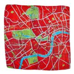 Silk Scarf Large – London Red 110 x 100cm
 Silk Scarf Large – London Blue 110 x 100cm
 Silk Scarf Large – London Pink 110 x 100cm
 Framed London Triptych 1863 Dower Cassell
Birch Tree with LED Lights – 100cm
Framed London Triptych 1863 Dower Cassell
Birch Tree with LED Lights – 100cm
 Discovering Timber-Framed Buildings
 Pair of Black Oval Poster Grippers up to 100cm with end caps and slide hangers
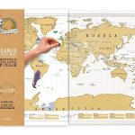 Framed World Scratch Map
 Europe RAISED RELIEF – FRAMED
World Michelin Wall Map PIN-BOARD FRAMED
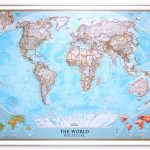
NGS Executive Political World Wall Map FRAMED
World Michelin Wall Map MAGNETIC-BOARD FRAMED
Europe RAISED RELIEF – FRAMED
World Michelin Wall Map PIN-BOARD FRAMED
NGS Executive Political World Wall Map FRAMED
World Michelin Wall Map MAGNETIC-BOARD FRAMED
 NGS Executive Political World Wall Map ENLARGED, FRAMED
 World NGS Classic Wall Map STANDARD SIZE, PIN BOARD, FRAMED
 NGS Classic Political World Wall Map ENLARGED, PIN BOARD, FRAMED
 World Maps International Political Wall Map X-LARGE PIN-BOARD FRAMED
 World Maps International Political Wall Map MEDIUM PIN-BOARD FRAMED with flags
 World Maps International Political Wall Map SMALL PIN-BOARD FRAMED with flags
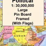 World Maps International Political Wall Map LARGE PIN-BOARD FRAMED with flags
 World Maps International Political Wall Map X-LARGE MAGNETIC-BOARD FRAMED
 World Maps International Political Wall Map SMALL PIN-BOARD FRAMED without flags
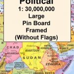 World Maps International Political Wall Map LARGE PIN-BOARD FRAMED without flags
 World Maps International Political Wall Map MEDIUM PIN-BOARD FRAMED without flags
 World Maps International Political Wall Map MEDIUM MAGNETIC-BOARD FRAMED with flags
 World Maps International Political Wall Map SMALL MAGNETIC-BOARD FRAMED with flags
 World Maps International Political Wall Map LARGE MAGNETIC-BOARD FRAMED with flags
 World Maps International Political Wall Map LARGE MAGNETIC-BOARD FRAMED without flags
 World Maps International Political Wall Map MEDIUM MAGNETIC-BOARD FRAMED without flags
 World Maps International Political Wall Map SMALL MAGNETIC-BOARD FRAMED without flags
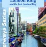 Grand Union Canal: Milton Keynes to London, with the London & East London Rings Heron Map
 London Quiz: How Well Do You Know London?: 400 Provocative, Curious and Humorous Questions to Enlighten and Entertain
 London`s Afternoon Teas, Updated Edition: A Guide to the Most Exquisite Tea Venues in London
 Modern London: An illustrated tour of London`s cityscape from the 1920s to the present day
 Bloody London : 20 Walks in London, Taking in its Gruesome and Horrific History
 Civil War London: A Military History of London Under Charles I and Oliver Cromwell
 Seats of London: A Field Guide to London Transport Moquette Patterns
 London Graffiti and Street Art: Unique Artwork from London`s Streets
 London (3): North West London Pevsner Architectural Guide
 Postmodern London Map – Guide to postmodernist architecture in London
 London Convention & London Protocol, 2016 Edition