Disclosure : This site contains affiliate links to products. We may receive a commission for purchases made through these links.
Fogo – Brava AB Kartenverlag Hiking Map
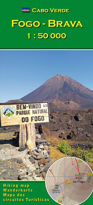
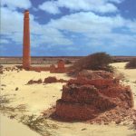
Fogo and Brava in the Cape Verde archipelago on a detailed, GPS compatible, contoured map at 1:50,000 from AB Kartenverlag highlighting over 50 hiking routes, with a street plan of central Sรฃo Filipe.The map has contours at 100m intervals, spot heights and elevation colouring enhanced by relief shading to present the topography. Roads and tracks are clearly marked, as well as places of interest and various local facilities, including medical centres.Also highlighted on the map are over 50 selected walks, all graded according to the degree of difficulty, the type of terrain, ascent/descent and the average hiking time. Each walk is also annotated to show if the route is suitable for a mountain bike.The map is GPS compatible and has latitude and longitude grid at 1` intervals. Map legend and all text include English.On the reverse of the map beautiful colour photos show some of the views along the routes. Also included are insets with a street plan of central Sรฃo Filipe annotated with places of interest and facilities, plus a map of Fogo showing the extent of lava flows from various eruptions between 1724 and 1995.

Related Products:
 Santo Antรฃo AB Kartenverlag Hiking Map
 Sรฃo Vicente – Mindelo AB Kartenverlag Hiking Map
 Sรฃo Nicolau AB Kartenverlag Hiking Map
 Boa Vista AB Kartenverlag Hiking Map
 Santiago AB Kartenverlag Hiking Map
 Sao Paulo & Brazil South Coast ITMB
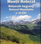 Retezat Mountains Dimap Hiking Map
 Gurghiu Mountains Northern and Central Dimap Hiking Map
 Parang Mountains Dimap Hiking Map
 Toubkal Hiking Map & Marrakech Street Plan
 Namibia Map Studio Adventure Map
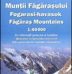 Fagaras Mountains Dimap Hiking Map
 Padis Dimap Hiking Map
 Cederberg Mountains Hiking Set (2-map set)
 Madeira Kompass 234
 Middle East ITMB Travel Atlas
 Bihor Mountains Dimap Hiking Map
 Bornholm Kompass 236
Gilau Mountains Dimap Hiking Map
Tarcau Mountains and Ghimes Dimap Hiking Map
Rarau-Giumalau Mountains and Bucovina Monasteries Dimap Hiking Map
Bornholm Kompass 236
Gilau Mountains Dimap Hiking Map
Tarcau Mountains and Ghimes Dimap Hiking Map
Rarau-Giumalau Mountains and Bucovina Monasteries Dimap Hiking Map
 Hungary: Cartographia Hiking Maps
St Anna Lake Dimap Hiking Map
Hungary: Cartographia Hiking Maps
St Anna Lake Dimap Hiking Map
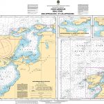 CHS Chart 4529 – Fogo Harbour, Seal Cove and Approaches
 Lesbos Geopsis 211
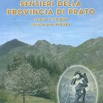 Prato Province Hiking Routes
 Muntanyes de Llibertat Hiking Circuit
 AB Kartenverlag Hiking Maps
 Kos Geopsis 212
 Giurgeu and Hasmas Mountains Dimap Hiking Map
 San Gimignano – Volterra
 Mallorca Hiking Atlas Kompass 2753
Caliman Mountains Dimap Hiking Map
Mallorca Hiking Atlas Kompass 2753
Caliman Mountains Dimap Hiking Map
 Central Lycia – Kas and neighbouring Areas
 Fagaras – Bucegi – Piatra Craiului terraQuest Trekking Map
 Madeira K+F Outdoor Map
 Italy: IGA 25K Hiking Maps of Central Italy
 Italy: IGA 50K Hiking Maps of Central Italy
 Bergen Cappelen Street Plan