Disclosure : This site contains affiliate links to products. We may receive a commission for purchases made through these links.
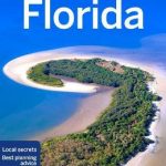
Florida Hildebrand`s Road Map
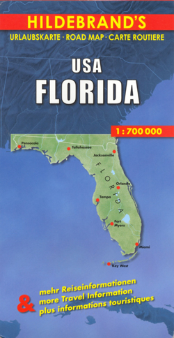
Florida at 1:700,000 on an indexed road map from Hildebrand with several panels showing in greater detail the most visited parts of the state, including the Orlando – Disney World – Cape Canaveral area, the coast with Miami and Palm Beach, etc, plus street plans.The main map shows the whole of the state, with the western part of the panhandle on a separate inset. Road network prominently indicates principal highways, distinguishing between toll and free access routes, clearly shows road numbers, and gives diving distances on main and connecting routes. Scenic roads are highlighted. Colouring and/or graphics indicate national parks and other protected areas, marshlands, etc. The map has latitude and longitude lines at 30’ intervals. The index is next to the map; map legend includes English.Next to the main map and on the reverse are panels showing city centre street plans of Miami, Orlando and Tampa, plus enlargements presenting in greater detail: St. Petersburg – Tampa – Sarasota area, Palm Beach – Fort Lauderdale – Miami / Miami Beach coastline, Orlando – Kissimmee – Disney World – JFK Space Center / Cape Canaveral area, plus the coast of the panhandle.

Related Products:
 Florida F&B
 Florida Easy-to-Read Rand McNally
 Moon Florida
 Florida USA 11 Hallwag Road Map
 Moon South Florida & the Keys Road Trip (First Edition): With Miami, Walt Disney World, Tampa & the Everglades
 Miami & South Florida ITMB
 Orlando & Central Florida ITMB
 Southeast USA – The South & Florida Borch
 USA South: Atlantic States ITMB
 The Rough Guide to Florida
 Lonely Planet Best of Florida
 Florida NGS Guide Map
 Florida Marco Polo Guide
 Florida Central & Eastern Regional Rand McNally
 Fodor`s Florida
 DK Eyewitness Family Guide Florida
 Miami – Fort Lauderdale – West Palm Beach FL Regional Rand McNally
 Golden Triangle Road Map – Delhi – Agra – Jaipur
 Miami Borch
 Cape Verde AB Kartenverlag Road and Leisure Map
 Thailand Periplus Travel Map
 Reg 8.3 Florida Southeast, Lake Worth to Plantation Key
 DK Eyewitness Travel Guide Florida
 Oregon & Northern California Coast Road & Recreation Map
 Miami FL Rand McNally
 Miami – South Beach Red Maps
 South Africa F&B
 Florida & US Deep South ITMB
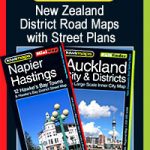 New Zealand: Kiwimaps District Road Maps with Street Plans
 Estonia Jana Seta Road Atlas
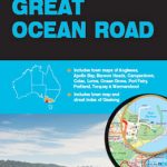 Great Ocean Road UBD Gregory`s 308
 Bulgaria Cartographia Road Map
 Lonely Planet Florida
 Bulgaria – City Centres Domino Road Map
 Accra & Ghana South ITMB
 Zambia & Eastern Africa ITMB Road Map
Brittany – Brest – Rennes K+F Regional Road Map
Zambia & Eastern Africa ITMB Road Map
Brittany – Brest – Rennes K+F Regional Road Map
 Sunny Beach – Nesebar
 Florida Reise Know-How