Disclosure : This site contains affiliate links to products. We may receive a commission for purchases made through these links.
Florence: Capital of the Kingdom of Italy 1865-1871
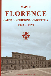
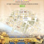
A detailed street plan of central Florence showing the city as it was between 1865 and 1871, the period during which it served as capital of the Kingdom of Italy. Drawn by Edizioni Multigraphic using information from various historical sources including the city’s official archives, the map presents the famous landmarks as government buildings, e.g. Palazzo Pitti as the Royal Palace and Palazzo Vecchio as the Parliament. It is interesting to notice the central railway station ‘Santa Maria Novella”, which here appears in its original shape before the enlargement of the 1930s; the Art secondary school of Porta Romana is still used as Royal Stables, etc. The map also shows the new tree-lined avenues: this was the most visible change to the city structure, since the old city walls were knocked down and replaced with the avenues. Over 80 locations are cross-referenced to the accompanying list of public buildings, and the map also provides historical notes which include a list of ministerial office holders during the city’s tenure as the capital of Italy. Map legend and all the text are in English.


