Disclosure : This site contains affiliate links to products. We may receive a commission for purchases made through these links.
Flixton 1904

Flixton in 1904 in a fascinating series of reproductions of old Ordnance Survey plans in the Alan Godfrey Editions, ideal for anyone interested in the history of their neighbourhood or family. The map covers the area from Higher Irlam, in the top left corner, and the Manchester Ship Canal eastward to Flixton station. Features include a stretch of the Cheshire Lines Railway, Flixton station, Flixton House, Peers Fold, Wibbersley, St Michael`s church, Towns Gate, Well Acre, Irlam Locks, part of Soap & Candle Works, mineral railway alongside canal, old course of River Irwell, part of Higher Irlam, etc. On the reverse are extracts from a contemporary street directory, incl Carrington Road, Flixton Road, Irlam Road and Woodsend Road. About the Alan Godfrey Editions of the 25″ OS Series:Selected towns in Great Britain and Ireland are covered by maps showing the extent of urban development in the last decades of the 19th and early 20th century. The plans have been taken from the Ordnance Survey mapping and reprinted at about 15 inches to one mile (1:4,340). On the reverse most maps have historical notes and many also include extracts from contemporary directories. Most maps cover about one mile (1.6kms) north/south, one and a half miles (2.4kms) across; adjoining sheets can be combined to provide wider coverage.FOR MORE INFORMATION AND A COMPLETE LIST OF ALL AVAILABLE TITLES PLEASE CLICK ON THE SERIES LINK.

Related Products:
 Urmston 1926
Lower Irlam and Cadishead 1926
Urmston 1926
Lower Irlam and Cadishead 1926
 Royston 1904
Newhaven & Granton 1904 – 1.15
Royston 1904
Newhaven & Granton 1904 – 1.15
 Aberystwyth 1904
Lampeter 1904
Marsden 1904
Barnsley 1904
Aberystwyth 1904
Lampeter 1904
Marsden 1904
Barnsley 1904
 Cudworth 1904
Fallowfield 1904
Paignton 1904
Exeter 1904 – 80.06b
New Quay 1904
Llandovery 1904 – 18.13
Monk Bretton & Smithies 1904 – 274.04
Irlam Hall 1926
Cudworth 1904
Fallowfield 1904
Paignton 1904
Exeter 1904 – 80.06b
New Quay 1904
Llandovery 1904 – 18.13
Monk Bretton & Smithies 1904 – 274.04
Irlam Hall 1926
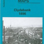 Clydebank 1896
Gateacre 1904
Torquay 1904
Aberaeron 1904
Bideford 1904 – 19.06
Clydebank 1896
Gateacre 1904
Torquay 1904
Aberaeron 1904
Bideford 1904 – 19.06
 King`s Lynn 1904 – 33.10
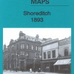 Shoreditch 1893 – 51.2
Shoreditch 1872 – 51.1
Shoreditch 1893 – 51.2
Shoreditch 1872 – 51.1
 Shoreditch 1914 – 51.3
 Oldbury & Spon Lane 1904 – 68.14a
 Tipton 1904
Boothstown and Astley Green 1904
Tipton 1904
Boothstown and Astley Green 1904
 Woolton 1904
Trafford Park South 1937
Holmfirth 1904
Barnsley South 1904
Woolton 1904
Trafford Park South 1937
Holmfirth 1904
Barnsley South 1904
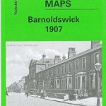 Barnoldswick 1907
 Southall Green 1935
 Warwick North 1923
Bulwell 1913 – 38.05
Blackburn 1929
Blackburn 1910
Warwick North 1923
Bulwell 1913 – 38.05
Blackburn 1929
Blackburn 1910
 South Croydon 1895 – 14.14
 South Croydon 1895 – 159.2