Disclosure : This site contains affiliate links to products. We may receive a commission for purchases made through these links.
Categories
-
Best Sellers
-

The Slaves of the Cool Mountains
Beijing, 1956: foreign correspondent Alan Winnington heard reports of slaves being freed in the mountains of south-west China. The following year he travelled to Yunnan province Read More » -
Admiralty Chart 327 – Northern Approaches to Yanbu`
Admiralty standard nautical charts comply with Safety of Life at Sea (SOLAS) regulations and are ideal for professional, commercial and recreational use. Charts within the series Read More » -
CHS Chart 6415 – Three Finger Creek to Saline Island Kilometre 650-730
The official Canadian charts provide an excellent range of scales for the whole length of Canada`s coastline as well as the Grat Lakes and comply with Read More » -

Tales from the Underworld: Selected Shorter Fiction
These are darkly funny, searingly honest short stories from Hans Fallada, author of bestselling Alone in Berlin. In these stories, criminals lament how hard it is Read More » -

Easter Puzzles
Spot the differences between Easter scenes, complete a springtime crossword puzzle, match bunnies to their silhouettes and much more in this delightful mini activity book, filled Read More » -
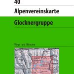
Glocknergruppe Alpenverein KOMBI Map 40
Glocknergruppe area of the Alps in a hiking edition at 1:25,000 from a series of detailed, GPS compatible maps published by the DAV – Deutscher Alpenverein Read More » -

Incredibuilds – Fantastic Beasts – Swooping Evil: Deluxe Model and Book Set
Learn how the Swooping Evil and other magical creatures were brought to life int he Fantastic Beasts and Where to Find Them film. Filled with incredible Read More » -

Altea CNIG Topo 848-1
Topographic coverage of mainland Spain at 1:25,000 published by the Centro Nacional de Informaciรณn Geograficรก, the country’s civilian survey organization. The maps have contours at 10m Read More » -
Ios Orama Editions 308
-
Fleron – Verviers
Topographical survey of Belgium at 1:20,000 from Nationaal Geografisch Instituut / Institut Gรฉographique National, the country’s national survey organization. Each 20K map covers one quarter of Read More »
-


