Disclosure : This site contains affiliate links to products. We may receive a commission for purchases made through these links.
Disclosure : This site contains affiliate links to products. We may receive a commission for purchases made through these links.
Categories
-
Best Sellers
-

NOAA Chart 12284 – Patuxent River’”Solomons lsland and Vicinity
NOAA maintains the nautical charts and publications for U.S. coasts and the Great Lakes. Over a thousand charts cover 95,000 miles of shoreline and 3.4 million Read More » -

Viterbo Province
Viterbo Province at 1:150,000 in a series of handy size provincial road maps from Litografia Artistica Cartografica (LAC) with more minor local roads and country tracks Read More » -

The World of Roald Dahl
Welcome to the wondercrump world of all things Roald Dahl, filled with fantastic facts, exciting extras, quirky quizzes and much more!Join Roald Dahl`s best-loved characters for Read More » -
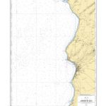
SHOM Chart 6169 – Abords de Safi
PLEASE NOTE: the chart will be ordered for you if not currently in stock. Please allow 1-2 weeks for the chart to reach Stanfords. SHOM charts Read More » -

Thomas Cook `Traveller` Guides
The Thomas Cook โ€Travellersโ€ guide series cover an extensive range of cities, regions and countries world-wide and explore the historical, cultural and geographical aspects of the Read More » -

Inverclyde and Renfrewshire: 40 favourite walks
Bordered by the city of Glasgow to the east and the Firth of Clyde to the west, the villages and towns of Inverclyde and Renfrewshire prospered Read More » -

Historium Activity Book
Following Historium, the latest edition in the Welcome to the Museum series, comes this fantastic companion activity book. Bursting with fascinating facts and puzzles, this book Read More » -

The Secret of Old Mill
Peter and Janet think Old Mill is perfect for their Seven Society meetings – until they make a startling discovery about some stolen goods. So the Read More » -

Switzerland: Hallwag 50K Mountain Biking Maps
Popular mountain biking areas of Switzerland on waterproof and tear-resistant, contoured maps at 1:50,000 from Hallwag, each highlighting several circuits and providing route profiles, guidance on Read More » -

Appennino Reggiano – Lunigiana – Garfagnana Edizioni Multigraphic 15
Appennino Reggiano: Lunigiana – Garfagnana, map no. 15, in a series of walking maps covering the Ligurian Alps and the coast, the crest of the Apennines Read More »
-


