Disclosure : This site contains affiliate links to products. We may receive a commission for purchases made through these links.
Fjallabak
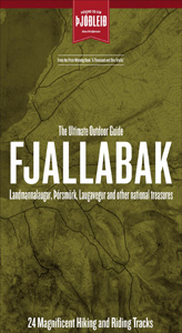
Fjallabak area of Iceland at 1:100,000 in a series of hiking and recreational topographic maps from Sogur Utgafa, with 27 hiking and riding tracks highlighted and described in detail. The map presents detailed picture of the area’s topography, with contours at 20m intervals supplemented by spot heights and relief shading. The colouring indicates different types of terrain and vegetation: lava, sand and mudflats, glaciers, etc. Road network includes jeep roads and tracks; footpaths and bridleways are marked with symbols indicating which tracks are not recommended for hikers or horses. Locations of campsites and shelters, country hotels and farmhouses, swimming pools, gas stations are also marked.Each title of this series carries on one side an enlargement of the chosen area with descriptions of the individual walks/or rides (descriptions and map legend are in English only), and on the reverse a physical map of the whole Iceland with basic tourist information. The map is printed on paper and does not feature a UTM grid (so it is not GPS compatible).To see the list of titles in this series please click on the series link.

Related Products:
 Landmannalaugar – รorsmork – Fjallabak – Eyjafjallajokull Volcano
 Kjalvegur
 Thingvellir
 Iceland: Sogur Utgafa 100K Recreational Maps
 Iceland: Mรกl og Menning Touring and Hiking Maps
 Hornstrandir
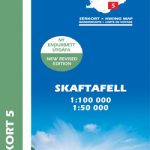 Skaftafell
 Snรฆfellsnes
 Reykjanes – รingvellir
 Lรณnsรถrรฆfi – Snรฆfell
 Gullfoss – Geysir – Hekla
 Kjรถlur – Langjรถkull – Kerlingrafjรถll
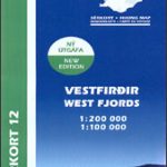 Western Fjords
 Akureyri – Mรฝvatn – Dettifoss
Askja – Herdubreid – Kverkfjรถll
Akureyri – Mรฝvatn – Dettifoss
Askja – Herdubreid – Kverkfjรถll
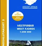 Iceland Western Fjords
 Postavarul and Piatra Mare Mountains
 Iceland North: Hvammstangi – Mรฝvatn Lake
 Iceland West: Akranes – Eirรญksjรถkull Glacier
 Iceland Mal og menning Tourist Map
 Iceland North East
 Iceland South West
 Iceland North West
Iceland South East
Iceland North West
Iceland South East
 Iceland North East: Hรบsavik – Lake Mรฝvatn – Bakkagerรฐi
 Iceland South East: Southern Vatnajรถkull
 Iceland East: Vatnajรถkull – Egilsstaรฐir
 Ljubljana and Environs Kartografija Tourist Map
 Iceland Cental: Langjรถkull – Hofsjรถkull – Vatnajรถkull
 Iceland South-West: Reykjavik ‘“ Eyjafjallajรถkull
 Posavsko Hribovje Kartografija Tourist Map
 Iceland Mal og menning Road Atlas 2021-2023
 Iceland Central Highlands
 Primorska Kartografija Tourist Map
 Iceland Wall Map
 Stajerska – Slovene Hills – Haloze – Boc Kartografija Tourist Map
 Babia Gรณra and Environs
 Iceland: Mรกl og Menning 200K Road Maps
 Notranjski Kras – Brkini – Dolenjska – Bela Krajina Kartografija Tourist Map
 Julian Alps West Kartografija Tourist Map