Disclosure : This site contains affiliate links to products. We may receive a commission for purchases made through these links.
Fish River Canyon & the Richtersveld NGS Adventure Map 3201
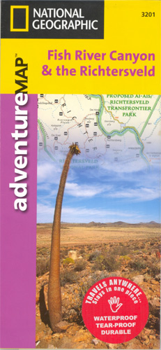
Waterproof, tear-resistant map with plenty of tourist information. The main map at 1:476,000 extends from Springbok in the Western Cape state of South Africa to Keetmanshoop in Namibia, covering the Richtersveld National Park in RSA and the adjoining parks in Namibia: Ai-Ais/Richtersveld Transfrontier Park, Fish River Canyon, and Gondwana Canyon Nature Park. Relief shading with spot heights indicates the topography. Road network includes tracks suitable only for 4×4 vehicles. Numerous symbols highlight various types of accommodation, visitors centre, places of interest, etc. Separate panels give tips for tours, vehicle hire and adventure activities. Latitude and longitude are shown in the margins at 30’ intervals. A separate inset at 1:800,000 extends the main map across the restricted part of the Namib Desert to Lรผderitz.On the reverse there is a more detailed contoured map covering both the Richtersveld parks and the Fish River Canyon at 1:230,000, highlighting the main hiking trial in the canyon. There are also street plans of Springbok and Keetmanshoop, a map of the Lรผderitz Peninsula at 1:105,000, and a plan of the Kolmanskop Ghost Town.

Related Products:
 Fish River Canyon
 Richtersveld National Park and Northern Namaqualand
 Grand Canyon North and South Rims – Grand Canyon National Park AZ NGS Trails Illustrated Map 261
 Namibia – Botswana Nelles
 Grand Canyon National Park West AZ
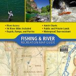
 South Platte River – Elevenmile Canyon Reservoir to Chatfield Reservoir
 Salt River Canyon – Tonto National Forest AZ
 Grand Canyon: The Complete Guide: Grand Canyon National Park
 Grand Canyon National Park East AZ
 South Africa – Namibia – Botswana – Zimbabwe Nelles
 Colca Canyon – Cotahuasi Canyon
 South Platte River Middle Fork – Alma to Elevenmile Canyon Reservoir
 Grand Canyon & Arizona ITMB
 Namibia Map Studio Road Atlas
 Fish On, Fish Off: The Misadventures and Odd Encounters of the Self-Taught Angler
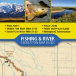
 Colorado River – Kremmling To Glenwood Springs CO NGS Fishing & River Map-Guide 2307
 Namibia Map Studio Adventure Map
 Grand Canyon National Park Map Pack Bundle – Trails Illustrated National Parks
 Grand Canyon
 Moon Yosemite, Sequoia & Kings Canyon (Eighth Edition)
 California: Sacramento’“San Joaquin River Delta Adventure Map/Guide
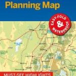 Zion & Bryce Canyon National Parks Lonely Planet Planning Map
 Moon Grand Canyon
 Bryce Canyon & Brian Head UT Trail Map
 Lonely Planet Grand Canyon National Park
 Best Easy Day Hikes Grand Canyon National Park
 Grand Canyon National Park Lonely Planet Planning Map
 One Fish, Two fish, Red Fish, Blue Fish
 Central USA & the Mississippi River ITMB
 Namibia 3in1 Flash Guide
 Bryce Canyon National Park UT
 Compass American Guides: Yosemite and Sequoia/Kings Canyon National Parks
 Bart`s Fish Tales: A fishing adventure in over 100 recipes
 Sequoia – Kings Canyon National Parks CA
 FISH : the Complete Fish & Seafood Companion
 Lonely Planet Zion & Bryce Canyon National Parks
 Moon Sequoia & Kings Canyon (First Edition): Hiking, Camping, Waterfalls & Big Trees
 Grand Canyon Country
 Gould`s Book of Fish – A Novel in Twelve Fish
 Moon Utah (Thirteenth Edition): With Zion, Bryce Canyon, Arches, Capitol Reef & Canyonlands National Parks