Disclosure : This site contains affiliate links to products. We may receive a commission for purchases made through these links.
Finsbury Park and Stroud Green 1894
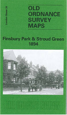
Finsbury Park and Stroud Green in 1894 in a fascinating series of reproductions of old Ordnance Survey plans in the Alan Godfrey Editions, ideal for anyone interested in the history of their neighbourhood or family. Three versions for this area have been published to present how it developed across the years. The 1870 map shows an almost rural area, just before the park was created. The 1894 and 1912 versions show it progressively more built up, especially with the development of Harringay, the opening of more railway stations and the development of Finsbury Park. Coverage runs from Topsfield Hall at Crouch End southward to Fonthill Road, eastward to Manor House. Features include Stroud Green, Hornseywood Tavern, Northumberland House, Mount Pleasant, Crouch Hill station (on Tottenham and Hampstead railway), Manor House pub, numerous named villas and large houses in the Crouch Hill area. The GNR line runs north-south through the centre of the map. The GNR High Barnet branch and Tottenham and Hampstead lines are also shown. On the reverse is a directory of Crouch Hill in 1890.About the Alan Godfrey Editions of the 25″ OS Series:Selected towns in Great Britain and Ireland are covered by maps showing the extent of urban development in the last decades of the 19th and early 20th century. The plans have been taken from the Ordnance Survey mapping and reprinted at about 15 inches to one mile (1:4,340). On the reverse most maps have historical notes and many also include extracts from contemporary directories. Most maps cover about one mile (1.6kms) north/south, one and a half miles (2.4kms) across; adjoining sheets can be combined to provide wider coverage.FOR MORE INFORMATION AND A COMPLETE LIST OF ALL AVAILABLE TITLES PLEASE CLICK ON THE SERIES LINK.

Related Products:
 Finsbury Park & Stroud Green 1870 – 20.1
 Finsbury Park & Stroud Green 1912 – 20.3
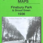 Finsbury Park & Stroud Green 1936 – 20.4
 Kensal Green & Queen`s Park 1894 – 47.2
 Wood Green 1894 – 7.2
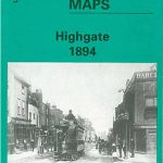 Highgate 1894 – 19.2
Upper Holloway 1894 – 29.2
Blackheath & Greenwich Park 1894 – 105.2
Highgate 1894 – 19.2
Upper Holloway 1894 – 29.2
Blackheath & Greenwich Park 1894 – 105.2
 Tottenham (North) 1894 – 8a
 East Dulwich & Peckham Rye 1894 – 117.2
 Clapham Park & Balham 1894 – 125.2
 Holland Park & Shepherds Bush 1894 – 73.2
 Euston & Regent`s Park 1894 – 49.2
 Willesden and Stonebridge Park 1936
 Alexandra Park & South Friern 1894 – 6a
 Isleworth 1894
East Finchley & Hampstead Garden Suburb 1894-1911 – 10.3
Isleworth 1894
East Finchley & Hampstead Garden Suburb 1894-1911 – 10.3
 Bethnal Green & Bow 1894 – 52.2
 North Shields & Chirton 1894
 Brixton & Herne Hill 1894 – 116.2
Wood Green 1912 – 7.3
Brixton & Herne Hill 1894 – 116.2
Wood Green 1912 – 7.3
 Wood Green 1935 – 7.4
 South Harrow and Northolt Park 1935
 Kiveton Park and Wales 1901
 Hampstead 1866 – 27.1
 Beckenham South 1894
 Castle Douglas 1894
 Upper Sydenham 1894 – 137.2
 Shortlands 1894
 Twickenham & Petersham 1894 – 122
 Eltham Green 1894 – 120.2
Wembley Park 1895
Eltham Green 1894 – 120.2
Wembley Park 1895
 South Acton & Gunnersbury Park 1935 – 71.4
 Willesden Junction 1894
 Highgate 1869 – 19.1
Finsbury Square & Circus 1873 – 7.56
Highgate 1869 – 19.1
Finsbury Square & Circus 1873 – 7.56
 Brentford 1912 – 83.3
 Upper Holloway 1869
 Hampstead 1915 – 27.3
 Holloway & Highbury 1937 – 29.4