Disclosure : This site contains affiliate links to products. We may receive a commission for purchases made through these links.
Finland Road Atlas GLOVEBOX, SPIRAL-BOUND
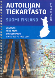
Finland Road Atlas from Karttakeskus in a glovebox size spiral-bound format, covering southern Finland at 1:650,000 with the rest of the country, north of Oulu, at 1:800,000. The atlas includes an enlargement for the Helsinki area, street plans of 12 main towns, plus a distance table.Main roads and connecting routes are very clearly presented and classified, but this glovebox version shows considerably fewer smaller local roads and tracks than the publishers’ larger A4 atlas at 200/400K. Intermediate distances are shown on main routes and on selected connecting roads; locations of petrol stations and border crossings are marked. The atlas also shows railway lines, ferry routes and local airports. Symbols mark various places of interest, including campsites and youth hostels. Topography is indicated by spot heights; national parks and other protected areas are prominently highlighted. The maps have no geographical coordinates. Extensive index includes names of topographic features and national parks. Map legend includes English. Current edition of this atlas was published in 2014.The Helsinki area is shown in more details; 12 main towns are presented on plans with names of main streets and symbols for information centres, car parks and petrol stations, plus selected hotels.

Related Products:
 Poland: Carta Blanca/Kompas Road Atlas 2015 GLOVEBOX, SPIRAL-BOUND
 Finland Karttakeskus Motorbikers Road Atlas A5 SPIRAL-BOUND
Ukraine Road Atlas (500K, Spiral-bound)
Finland Karttakeskus Motorbikers Road Atlas A5 SPIRAL-BOUND
Ukraine Road Atlas (500K, Spiral-bound)
 Hungary – Budapest Road Atlas SPIRAL-BOUND
Italy F&B Great Road Atlas SPIRAL-BOUND
Finland Karttakeskus Road Atlas
Hungary – Budapest Road Atlas SPIRAL-BOUND
Italy F&B Great Road Atlas SPIRAL-BOUND
Finland Karttakeskus Road Atlas
 USA – Southern Canada Marco Polo Road Atlas A4 SPIRAL-BOUND
 Australia Hema Road & 4WD Touring Atlas A4 SPIRAL-BOUND
 Australia Hema Road & 4WD Atlas SPIRAL-BOUND
 Norway F&B Supertouring Road Atlas SPIRAL-BOUND
 Alps – Northern Italy MairDumont Road Atlas SPIRAL-BOUND
 USA NGS Adventure Edition Road Atlas A3 SPIRAL-BOUND
 Norway Cappelens Road Atlas A4 SPIRAL-BOUND
 Western Australia Hema Road & 4WD Track Atlas A4 SPIRAL-BOUND
 Australia Hema Road & 4WD Easy Read Atlas SPIRAL-BOUND
 USA Hema The Ultimate Road Atlas A3 SPIRAL-BOUND
 New Zealand Hema Touring Atlas A4 SPIRAL-BOUND
 Hungary Pocket Road Atlas SPIRAL-BOUND
 Benelux – North France Michelin Road Atlas SPIRAL-BOUND
 Australia Hema Handy Atlas SPIRAL-BOUND
 New Zealand Kiwimaps Compact Travellers Atlas SPIRAL-BOUND
Belarus Road Atlas
New Zealand Kiwimaps Compact Travellers Atlas SPIRAL-BOUND
Belarus Road Atlas
 Norway Road Atlas SPIRAL-BOUND
 Australia UBD Gregory`s Road Atlas A4 SPIRAL-BOUND
 Australia Hema Motorcycle Atlas Set – 200 Top Rides SPIRAL-BOUND
 Britain AA Glovebox Atlas SPIRAL-BOUND
 Southern Balkans F&B Superatlas SPIRAL-BOUND
 Finland East Karttakeskus Road Map
 Britain & Ireland Philip`s Handy Road Atlas A5 SPIRAL-BOUND
 Ukraine Kartografija Road Atlas 500K HARDBACK
Finland South Karttakeskus Road Map
Finland North Karttakeskus Road Map
Ukraine Kartografija Road Atlas 500K HARDBACK
Finland South Karttakeskus Road Map
Finland North Karttakeskus Road Map
 Finland West Karttakeskus Road Map
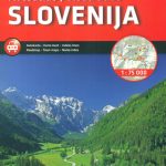 Slovenia Kartografija Road Atlas
 Finland Hallwag Road Map
 Manchester A-Z Big Street Atlas SPIRAL-BOUND
 Britain & Ireland Philip`s Complete Road Atlas 2017 SPIRAL-BOUND
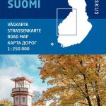
Finland: Karttakeskus 250/400K GT Road Maps
Britain & Ireland Philip`s Complete Road Atlas 2017 SPIRAL-BOUND
Finland: Karttakeskus 250/400K GT Road Maps
 Australia Great Desert Tracks Hema Atlas & Guide A4 SPIRAL-BOUND
 Europe Collins Essential Road Atlas 2021 A4 SPIRAL-BOUND