Disclosure : This site contains affiliate links to products. We may receive a commission for purchases made through these links.
Finland East Karttakeskus Outdoor Road Map
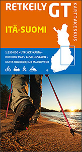
Eastern Finland at 1:250,000 on a double-sided cycling map from Karttakeskus with both national and local cycling routes, plus extensive tourist information including different types of accommodation. Enlargements show the routes in Iisalmi, Joensuu, Kajaani, Kuopio, Mikkeli, Savolinna, and Varkaus. Maps in this Outdoor series from Karttakeskus cover southern Finland at 1:250,000, with the northern part of the country at 1:400,000. An overprint prominently highlights both national and local waymarked cycling routes, indicating unsurfaced sections, intermediate distances and routes which are part of the EuroVelo network. Enlargements present in more detail the main urban areas. The maps also indicate mountain bike routes, plus selected nature trails and canoeing routes. Railway lines are shown with stations and ferry connections are marked. An extensive range of symbols provide additional information: tourist information offices; different types of accommodation (campsites, holiday villages, youth hostels, huts, shelters, etc), sport and recreational facilities and sites including horse riding, canoeing, bird-watching, etc. Topography is shown by contours at 20m intervals with spot heights, plus colouring and/or graphics for marshland, woodlands, etc. National parks and other protected areas are prominently marked. The maps also show which areas are currently covered by more detailed recreational maps published by Karttakeskus. The maps have both UTM and latitude/longitude grid lines. Each title also includes information of carrying cycles on public transport and notes on hiking, canoeing and snowmobile trails. Map legend and all the text include English.To see the other titles in this series please click on the series link.

Related Products:
 Finland North Karttakeskus Outdoor Road Map
 Finland West Karttakeskus Outdoor Road Map
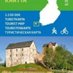
 Finland South Karttakeskus Outdoor Road Map
 Finland: Karttakeskus 250K/400K Outdoor Maps
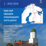
 Finland East Karttakeskus Road Map
Finland North Karttakeskus Road Map
Finland South Karttakeskus Road Map
Finland East Karttakeskus Road Map
Finland North Karttakeskus Road Map
Finland South Karttakeskus Road Map
 Finland West Karttakeskus Road Map
Finland: Karttakeskus 250/400K GT Road Maps
Finland West Karttakeskus Road Map
Finland: Karttakeskus 250/400K GT Road Maps
 Finland Karttakeskus Road Atlas
 Finland Karttakeskus Motorbikers Road Atlas A5 SPIRAL-BOUND
 Halti – Kilpisjรคrvi Karttakeskus Outdoor Map
 Finland Karttakeskus Travel Map + Guide
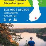
Finland: Karttakeskus Topographic Hiking Maps
Finland Karttakeskus Travel Map + Guide
Finland: Karttakeskus Topographic Hiking Maps
 Finland Road Atlas GLOVEBOX, SPIRAL-BOUND
 Finland: Karttakeskus Water Touring Maps
 Kuusamo Karttakeskus Outdoor Map
Pyhรค – Luosto Karttakeskus Outdoor Map
Saariselkรค – Sokosti Karttakeskus Outdoor Map
Koli – Ruunaa – Patvinsuo – Petkeljรคrvi Karttakeskus Outdoor Map
Kuusamo Karttakeskus Outdoor Map
Pyhรค – Luosto Karttakeskus Outdoor Map
Saariselkรค – Sokosti Karttakeskus Outdoor Map
Koli – Ruunaa – Patvinsuo – Petkeljรคrvi Karttakeskus Outdoor Map
 Repovesi – Mรคntyharju Karttakeskus Outdoor Map
 Karelia Karttakeskus Road Map
Nuuksio Luukki Karttakeskus Outdoor Map
Karelia Karttakeskus Road Map
Nuuksio Luukki Karttakeskus Outdoor Map
 Weinviertel East K+F Outdoor Map 19
 Finland and Northern Scandinavia NGS Adventure Map 3300
 Taunus East – Grosser Feldberg – Kรถnigstein – Bad Homberg K+F Outdoor Map 33
Lake Constance East – Friedrichshafen – Lindau – Ravensburg – Rorschach K+F Outdoor Map 44
Taunus East – Grosser Feldberg – Kรถnigstein – Bad Homberg K+F Outdoor Map 33
Lake Constance East – Friedrichshafen – Lindau – Ravensburg – Rorschach K+F Outdoor Map 44
 Cortina d`Ampezzo – Tre Cime di Lavaredo K+F Outdoor Map 6
 Val Pusteria – Dolomiti di Sesto K+F Outdoor Map 5
 Val Venosta / Vinschgau K+F Outdoor Map 1
 Merano and Environs – Texel Group – Sarntal – Bolzano K+F Outdoor Map 2
 Lake Como K+F Outdoor Map 9
Ruka – Oulanka Karhunkierros National Park
Lake Como K+F Outdoor Map 9
Ruka – Oulanka Karhunkierros National Park
 Bolzano – Caldaro – Wine Route – Eggental – Neumarkt – Cavalese K+F Outdoor Map 3
Hammastunturi – Ivalojoki – Juutua Karttakeskus Outdoor Map
Bolzano – Caldaro – Wine Route – Eggental – Neumarkt – Cavalese K+F Outdoor Map 3
Hammastunturi – Ivalojoki – Juutua Karttakeskus Outdoor Map
 Finland Hallwag Road Map
Hossa Karttakeskus Outdoor Map
Finland Hallwag Road Map
Hossa Karttakeskus Outdoor Map
 Groden – Seiseralm – Rosengarten – Sella – Marmolada K+F Outdoor Map 4
Lake Garda – Lake Idro – Monte Baldo – Verona K+F Outdoor Map 7
Groden – Seiseralm – Rosengarten – Sella – Marmolada K+F Outdoor Map 4
Lake Garda – Lake Idro – Monte Baldo – Verona K+F Outdoor Map 7
 Lake Maggiore – Lake Orta – Lake Varese K+F Outdoor Map 8