Disclosure : This site contains affiliate links to products. We may receive a commission for purchases made through these links.
Categories
-
Best Sellers
-

NOAA Chart 17330 – West Coast of Baranof Island’”Cape Ommaney to Byron Bay
NOAA maintains the nautical charts and publications for U.S. coasts and the Great Lakes. Over a thousand charts cover 95,000 miles of shoreline and 3.4 million Read More » -

Twisted Spirit Limited Mythical Monster Map A2 – without descriptions
-
Lake Constance F&B Leisure & Panorama
Lake Constance area at 1:75,000 on a touring and cycling map from Freytag & Berndt prominently highlighting scenic roads and special tourist routes, recommended cycling routes, Read More » -

Azilal – M`Goun
Azilal – M`Goun region in a series of GPS compatible maps at 1:160,000 published by EWP and West Col Productions and covering Morocco’s Atlas Mountains with Read More » -

Storzic – Kosuta Slovenian Alpine Club 25K Map
The Storzic – Kosuta area of the Kamnik ‘“ Savinja Alps at 1:25,000 in a series of contoured, GPS compatible recreational maps from Planinska zveza Slovenie Read More » -

Perim Hamam Towel – Cornflower
Perim is a great all-round pestemal towel. Available in a wide range of vibrant colours. Lightweight, compact, multi-use and quick to dry so perfect for holidays Read More » -

National Three Peaks Adventure Atlas: Ben Nevis, Scafell Pike, Snowdon
National Three Peaks Adventure Atlas from A-Z Map Company with cartography of the Ordnance Survey’s 1:25,000 Explorer series covering Ben Nevis, Scafell Pike and Snowdon supplemented Read More » -
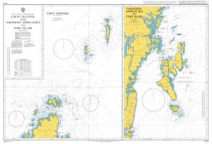
Admiralty Chart 1419 – Coco Channel and Northern Approaches to Port Blair
Admiralty standard nautical charts comply with Safety of Life at Sea (SOLAS) regulations and are ideal for professional, commercial and recreational use. Charts within the series Read More » -

The Kingdom: A Novel
-
Fellsstrond
-


