Disclosure : This site contains affiliate links to products. We may receive a commission for purchases made through these links.
Explore Aviemore – Rothiemurchus – Glenmore – Boat of Garten – Inshriach Forest

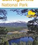
Aviemore and its environs, including Rothiemurchus, Glenmore, Boat of Garten and Inshriach Forest on a light, waterproof and tear-resistant, contoured and GPS compatible map at 1:35,000 from Footprint Walks, designed to highlight best local routes for walkers, trail runners and mountain bikers.On one side is a map of the whole area around Aviemore, from Kincraig to Boat of Garten and with the Cairngorm Mountain Railway and Ski Centre in the south-eastern corner. Topography is very effectively presented by contours at 10m intervals enhanced by relief shading plus colouring for woodlands. The map shows local tracks and paths, with the specially waymarked routes highlighted. Also indicated is the course of the No.7 route of the National Cycle Network. Symbols indicate various facilities including car parks, pubs and cafes, public toilets, etc. The map has 1km lines of the British National Grid. On the reverse are seven panels presenting extracts from the main map (at the same scale) accompanied by route descriptions: three walking and running routes (Loch an Eilein, Loch Morlich and the Ryvoan Pass, Craigellachie) and five mountain biking and running routes (Old Logging Way, Loch an Eilein, Speyside Way, Loch Einich, An Slugan).


