Disclosure : This site contains affiliate links to products. We may receive a commission for purchases made through these links.
Evia / Euboea – Skyros Anavasi 04
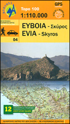
Evia (Euboea) with Skyros at 1:110,000 on a double-sided, contoured and GPS compatible, topographic road map from Anavasi printed on light, waterproof and tear-resistant synthetic paper. The map divides Evia north/south, with coverage on the southern half extending to the outskirts of Athens; the northern half extends west to Livadia. Contours at 100m intervals, enhanced by relief shading and altitude colouring, plus spot heights and plenty of names of peaks, mountain ranges, etc, provide and excellent picture of the region’s topography. Names of most towns and villages are in both Greek and Latin alphabets; names of geographical features and of places of interest highlighted on the map vary, with some shown only in Greek. Road network differentiates between asphalted and unsurfaced roads and indicates difficult roads. Driving distances are shows on main and selected local roads and locations of petrol stations are marked. Railway lines and ferry connections are included. Symbols highlight various places of interest including campsites and mountain refuges, archaeological sites, monasteries, beaches, harbours and marinas, etc. For GPS users UTM grid is drawn at 5-km intervals, with additional crosshairs for latitude and longitude at 1’ intervals. The index is in the detachable map cover.A special feature of this edition are bilingual descriptions of 12 best natural sites highlighted on the map. Map legend and the text include English.

Related Products:
 Evia / Euboea Terrain Editions
 Attica – Boeotia Anavasi 10
 Skyros Anavasi 10.14
 Greece Anavasi Road Map
 Peloponnese Anavasi Road Atlas
 Messinia Anavasi 17
 Macedonia Anavasi Regional Map R4
 Peloponnese Anavasi Regional Map R2
 Fokidha Anavasi 07
 Chania – Gavdos Anavasi 94
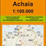 Achaia Anavasi 13
 Lasithi – Eastern Crete Anavasi 92
 Iraklion – Rethymnon – Central Crete Anavasi 93
 Greece: Anavasi 100K Touring Maps of Crete
 Spetses Anavasi 10.30
Greece: Anavasi 200K/250K Road Maps
Spetses Anavasi 10.30
Greece: Anavasi 200K/250K Road Maps
 Mt Dhirfis – Mt Xerovouni Anavasi 5.11
Greece: Anavasi Touring Maps of the Mainland and Peloponnese
Mt Dhirfis – Mt Xerovouni Anavasi 5.11
Greece: Anavasi Touring Maps of the Mainland and Peloponnese
 Rhodes & Symi Anavasi 10.38
 Anafi Anavasi 10.47
 Central Macedonia Terrain Editions Regional Map 2
 Thrace and Eastern Macedonia Terrain Editions Regional Map 1
 Greece F&B
 Italy North K+F Road Map
 Italy K+F Double-Sided Road Map
 Skyros Terrain Editions 322
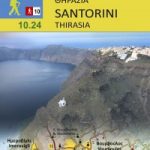 Santorini – Thirasia Anavasi 10.24
 Epirus and Western Macedonia Terrain Editions Regional Map 3
 Cyclades – Argosaronic Anavasi Regional Map R1
 Chios – Psara – Inouses Anavasi 10.31
 Northern Agrafa – Plastira Lake Anavasi 4.1
 Eastern Crete Terrain Editions 450
 Central Crete Terrain Editions 449
 Western Crete Terrain Editions 448
 Crete Terrain Editions Regional Map 7
 Kythnos Anavasi 10.44
 Tinos Anavasi 10.20
 Cephalonia / Kefalonia – Ithaca Anavasi 9.3
 Central Greece – Thessaly – Epirus Anavasi Regional Map R3