Disclosure : This site contains affiliate links to products. We may receive a commission for purchases made through these links.
Evesham and Bengeworth 1903
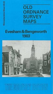
Evesham and Bengeworth in 1903 in a fascinating series of reproductions of old Ordnance Survey plans in the Alan Godfrey Editions, ideal for anyone interested in the history of their neighbourhood or family. The map is double-sided, covering the central and southern part of Evesham and extending across the River Avon to include Great Hampton and Little Hampton. The main map covers the centre of the town from Central Market and Swan Lane southward. Features include All Saints church, St Lawrence`s church, Avondale Mills, Bengeworth Bridge, Merstow Green, Town Hall, Vine Street, Abbey Gardens, The Workman Gardens, Owlett`s End, Little Hampton, Great Hampton, Evesham Workhouse, Hampton Manor, Eastwick, Fairfield, Midland Railway with Bengeworth station, No Gains Farm, St Andrew`s church, etc. On the reverse is part of the adjacent map 49.04 extending coverage eastward to include more of Bengeworth with St Peter`s church, old church site, brick works, cemetery, etc. A list of private residents from an 1896 directory is also provided. About the Alan Godfrey Editions of the 25″ OS Series:Selected towns in Great Britain and Ireland are covered by maps showing the extent of urban development in the last decades of the 19th and early 20th century. The plans have been taken from the Ordnance Survey mapping and reprinted at about 15 inches to one mile (1:4,340). On the reverse most maps have historical notes and many also include extracts from contemporary directories. Most maps cover about one mile (1.6kms) north/south, one and a half miles (2.4kms) across; adjoining sheets can be combined to provide wider coverage.FOR MORE INFORMATION AND A COMPLETE LIST OF ALL AVAILABLE TITLES PLEASE CLICK ON THE SERIES LINK.

Related Products:
 Evesham North 1903
 Brecon 1903 – 28.13
Redditch East 1903
Honiton 1903
Crickhowell & Llangattock 1903
Brecon 1903 – 28.13
Redditch East 1903
Honiton 1903
Crickhowell & Llangattock 1903
 Sheffield Central 1903
 Banbridge 1903
 Brandon 1903
Tiverton 1903
Axminster 1903 – 72.05
Sheffield (West) 1903 – 294.07b
Sheffield Darnall 1903
Sheffield Ecclesall Road and Sharrow 1903
Brandon 1903
Tiverton 1903
Axminster 1903 – 72.05
Sheffield (West) 1903 – 294.07b
Sheffield Darnall 1903
Sheffield Ecclesall Road and Sharrow 1903
 Hanworth and North West Hampton 1934
 Farnham 1913
Malvern Wells 1903
Hampton Court & East Molesey 1912 – 12.13
Nether Edge 1903
Loughborough 1901
Sheffield Heeley 1903
Shut End and Tansey Green 1903
Northfield South 1903
Farnham 1913
Malvern Wells 1903
Hampton Court & East Molesey 1912 – 12.13
Nether Edge 1903
Loughborough 1901
Sheffield Heeley 1903
Shut End and Tansey Green 1903
Northfield South 1903
 Hornsea 1926
King`s Norton 1903
Hornsea 1926
King`s Norton 1903
 Kingston upon Thames 1895 – 6.16
Bearwood 1903
South Yardley and Hay Mills 1903
Kingston upon Thames 1895 – 6.16
Bearwood 1903
South Yardley and Hay Mills 1903
 Watford South and New Bushey 1896
Selly Oak and Bournville 1903
Attercliffe 1903 – 295.01a
Newtownards 1901
Watford South and New Bushey 1896
Selly Oak and Bournville 1903
Attercliffe 1903 – 295.01a
Newtownards 1901
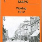 Woking 1912 – 17.09
Teddington & Hampton Hill 1894 – 131.2
Sheffield Park 1903
Woking 1912 – 17.09
Teddington & Hampton Hill 1894 – 131.2
Sheffield Park 1903
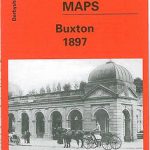 Buxton 1897 – 15.13
Stourport 1901
Buxton 1897 – 15.13
Stourport 1901
 Kempton Park & SW Hampton 1934 – 25.06
 Workington South 1923
Redditch West 1903
Workington South 1923
Redditch West 1903
 Stratford-upon-Avon & Evesham – Alcester OS Explorer Map 205 (paper)