Disclosure : This site contains affiliate links to products. We may receive a commission for purchases made through these links.
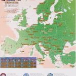
European Waterways Wall Map
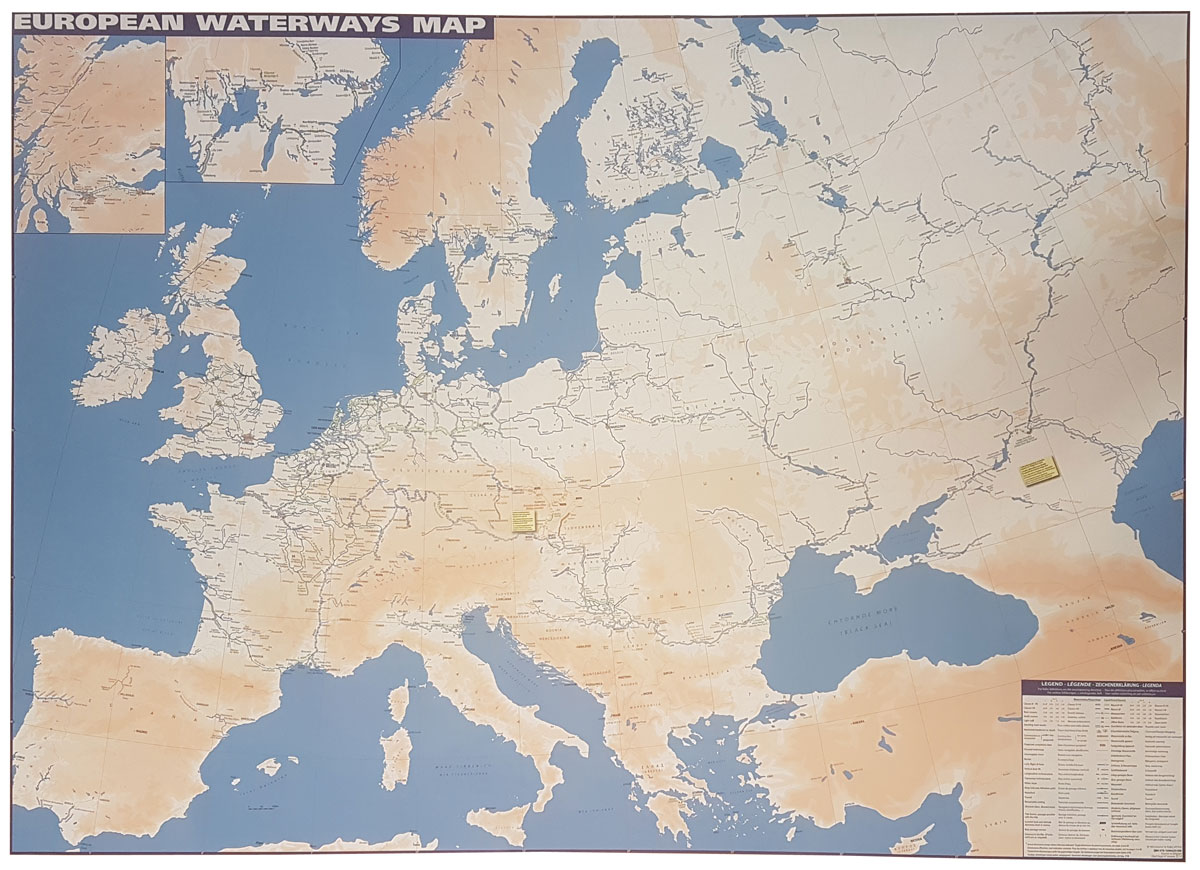
European Waterways flat wall map from Transmanche Publications offers a large flat map of Europe showing inland waterways. The double-sided map is at 1:4,000,000 on one side extending to the Urals and southern Scandinavia, the reverse with western and central Europe shown in greater detail at 1:1,500,000; plus further enlargements for the Benelux with the adjoining areas of France and Germany. Navigable waterways are coloured and/or classified according to their dimensions and the type of craft, and presented with symbols indicating locks, boat lifts, etc. The base map has altitude colouring to show the topography. Country and city names are given in local language (with English equivalents where useful). Map legend is in English, French, German and Dutch.

Related Products:
 European Waterways Map and Concise Directory 6th Edition
 The European Waterways – A User`s Guide
 France: Inland Waterways Map
 Belgium: Inland Waterways Map
 Inland Waterways of France
 Imray: UK and European Inland Waterways
 River Thames & the Southern Waterways Collins Nicholson Waterways Guide 7
 Inland Waterways Manual
 EuroRegs for Inland Waterways
 Through the French Canals: The Complete Planning Guide to Cruising the French Waterways
 Great Britain: Inland Waterways` Maps
 Ireland Inland Waterways
 Germany and Benelux Inland Waterways Map
 Grand Union, Oxford & the South East Collins Nicholson Waterways Guide 1
 Great Waterways Journeys: 20 Glorious Routes Circling England, by Canal and River
 Inland Waterways of France Map
 Four Counties & the Welsh Canals Collins Nicholson Waterways Guide 4
 Severn, Avon & Birmingham Collins Nicholson Waterways Guide 2
France: Editions du Breil Guides to Inland Waterways
Severn, Avon & Birmingham Collins Nicholson Waterways Guide 2
France: Editions du Breil Guides to Inland Waterways
 The Netherlands – Inland Waterways
 Lake Constance to Verona – E5 European Long-Distance Trail Kompass 2558
 The Inland Waterways Logbook
 Cruising French Waterways
 Waterways Guide 3 – Birmingham and the Heart of England
 Great Britain: Inland Waterways Map
 European City Breaks Collect & Scratch Print
 Waterways Past & Present: A Unique Portrait of Britain`s Waterways Heritage
Greenland and the European Arctic BAS Wall Map
Waterways Past & Present: A Unique Portrait of Britain`s Waterways Heritage
Greenland and the European Arctic BAS Wall Map
 Waterways Guide 2 – Severn, Avon & Birmingham
 North West & the Pennines Collins Nicholson Waterways Guide 5
 Birmingham & the Heart of England Collins Nicholson Waterways Guide 3
 Nicholson Waterways
 Norfolk Broads Collins Nicholson Waterways Guide
 Norfolk Broads (Collins Nicholson Waterways Guides)
 Mapping the Second World War: The Key Battles of the European Theatre from Above
 Sell Up And Cruise The Inland Waterways
 European Identity
 The European Union: A Citizen`s Guide: A Pelican Introduction
 Nottingham, York & the North East Collins Nicholson Waterways Guide 6