Disclosure : This site contains affiliate links to products. We may receive a commission for purchases made through these links.
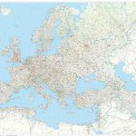
Europe Railway & Road ITMB
Europe’s railway and road networks on a double-sided map from ITMB at 1:3,350,000, with coverage extending east beyond Moscow to Kazan’ and Volgograd, plus coverage of most of Turkey. Northern Scandinavia, including most of Finland, is shown as an inset at 1:8,000,000.Although the map aims to show the railways distinguishing between high speed lines and the rest of the network, in areas with high density of motorway routes such as Belgium, the Netherlands or the Ruhr, railway lines are very difficult to see. Selected ferry routes are also marked. The map has political colouring to show different countries and is indexed.


