Disclosure : This site contains affiliate links to products. We may receive a commission for purchases made through these links.
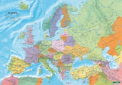
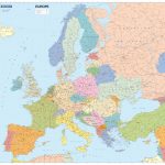
Europe Political F&B Wall Map GERMAN – with Metal Hanging Strips

Related Products:
 World F&B Political Wall Map MEDIUM – with Metal Hanging Strips GERMAN
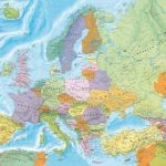 Europe Political F&B Wall Map ENGLISH – with Metal Hanging Strips
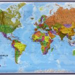
 World F&B Political Wall Map MEDIUM – with Metal Hanging Strips
 World Political/Physical – Sea Relief F&B Wall Map LAMINATED with Metal Hanging Strips
 Europe: Maps International Political Wall Map LARGE, HANGING STRIPS
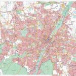 Munich F&B Wall Map – with Metal Hanging Strips
 Colour The World F&B Wall Map – with Metal Hanging Strips
 Australasia Political Wall Map: HANGING STRIPS
 Africa: Maps International Political Wall Map HANGING STRIPS
 Asia Maps International Political Wall Map HANGING STRIPS
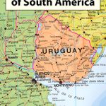 South America: Maps International Political Wall Map HANGING STRIPS
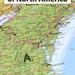 North America Maps International Political Wall Map HANGING STRIPS
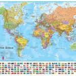 World Maps International Political Wall Map LARGE HANGING-STRIPS (with flags)
 World Maps International Political Wall Map LARGE HANGING-STRIPS (without flags)
 World Maps International Political Wall Map MEDIUM HANGING STRIPS (with flags)
 World Maps International Political Wall Map MEDIUM HANGING-STRIPS (without flags)
 World Maps International Political Wall Map SMALL HANGING-STRIPS (with flags)
 World Maps International Political Wall Map SMALL HANGING-STRIPS (without flags)
 World Maps International Political Upside-down Wall Map LARGE HANGING-STRIPS
 Europe Political F&B Wall Map GERMAN
 World Maps International Physical Wall Map LARGE HANGING-STRIPS
 Future Map Company Commemorative Olympic Games World Wall Map ENCAPSULATED WITH HANGING-STRIPS
World F&B Political Wall Map MEDIUM GERMAN
Future Map Company Commemorative Olympic Games World Wall Map ENCAPSULATED WITH HANGING-STRIPS
World F&B Political Wall Map MEDIUM GERMAN
 Europe Political F&B Wall Map
 Europe Political F&B Wall Map ENGLISH
 Europe IGN Political Wall Map
 Europe K+F Political Wall Map LAMINATED
 Europe Schofield & Simms Political Wall Map
 Europe XYZ Maps Political Wall Map PAPER
 Europe Michelin Political Wall Map ENCAPSULATED
 Europe Maps International Political Wall Map X-LARGE PAPER
 Europe Maps International Political Wall Map PAPER LARGE
 Europe Maps International Political Wall Map X-LARGE ENCAPSULATED
Europe Maps International Political Wall Map LARGE ENCAPSULATED
Europe Maps International Political Wall Map X-LARGE ENCAPSULATED
Europe Maps International Political Wall Map LARGE ENCAPSULATED
 Europe: Maps International Political Wall Maps
 Switzerland K+F Political Map GERMAN
 Europe Cycle Route Iron Curtain 4 – Hof to Szeged GERMAN
 Europe K+F Political Map