Disclosure : This site contains affiliate links to products. We may receive a commission for purchases made through these links.
Europe High 5 Edition Road Atlas
The first physical atlas with direct access to useful additional information from the InternetThe entirety of Europe on 432 pages in a scale of 1:800,000 clearly presented, including lots more travel information:- Road Companion (roadmaps) in a scale of 1:800,000, inclusive of the High 5 – Edition app technology for calling up additional travel information- Information on European countries: speed limits, areas, number of residents, emergency numbers, overview of the Schengen Area/Eurozone- Distance chart- Overview maps of Europe (1:5,000,000)- Overview of the city centres of the main European cities and towns (1:100,000)- Overview of the main lines of public transport, railways and ferries (1:5,000,000)- A selection of the local index including postal codes; the entire index can be viewed using the QR-code- Streets, ascents, woodland and mountain areas are easily recognisable thanks to the clear layout of the map.The ‘Interactive Mobile Atlas Europe” ‘“ a ‘paper backup” just in case…… and when used in conjunction with a smartphone, it is a great tool for planning trips.What’s not on the map is in the appBy scanning the page of the atlas you want with the High 5 Edition app, you can get a lot of useful additional information about major attractions and cities in Europe. The app is based on Augmented Reality technology and is available free of charge from the Apple App store and Google Play store.

Related Products:
 Europe High 5 Edition Camping Atlas
 Europe Marco Polo Road Atlas
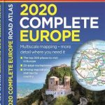 Europe Philip`s Complete Road Atlas 2020
 Europe Philip`s Big Road Atlas 2021 A3
 Europe F&B Compact Road Atlas
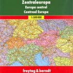 Central Europe F&B Road Atlas
 Switzerland High 5 Edition Road Map
 Germany – Europe ADAC Road Atlas LARGE 2021/2022
 France High 5 Edition Road Map
 Austria High 5 Edition Road Map
 Europe Collins Handy Road Atlas
 Croatia High 5 Edition Road Map
 Italy High 5 Edition Road Map
 Germany North High 5 Edition Road Map
 Germany High 5 Edition Road Map
 Germany South High 5 Edition Road Map
 Europe Philip`s Multiscale Road Atlas 2021 A4 FLEXIBACK
 Europe Philip`s Multiscale Road Atlas 2021 A4 SPIRAL-BOUND
 Europe Collins Essential Road Atlas 2021 A4 SPIRAL-BOUND
 Europe Philip`s Multiscale Road Atlas 2020 A4
 Europe AA Road Atlas 2020 FLEXI-BOUND
 Europe Falk Road Atlas
 Europe Hallwag Navigator Road Atlas
 Europe Collins Essential Road Atlas A4 SPIRAL-BOUND
 Europe Marco Polo Maxi Atlas 2017/2018 A3
 Central Europe F&B Compact Road Atlas
 Italy Marco Polo Road Atlas
 Croatia – Slovenia – Bosnia-Hercegovina Marco Polo Road Atlas
 Spain – Portugal Marco Polo Road Atlas
 Rail Atlas Europe
 France High 5 Edition Camping Map
 Europe Collins Road Map 2021
 Italy High 5 Edition Camping Map
 Germany North High 5 Edition Camping Map
 Germany South High 5 Edition Camping Map
 Europe Collins Map Road
 France Marco Polo Road Atlas
 USA: Antenna Audio American Highway Road Atlas – A4, PAPERBACK
 Victoria – The High Country Atlas & Guide A4 SPIRAL-BOUND
 Norway F&B Supertouring Road Atlas SPIRAL-BOUND