Disclosure : This site contains affiliate links to products. We may receive a commission for purchases made through these links.
Estonia
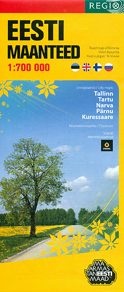
Estonia at 1:700,000 on an overview road map from the Tallinn based Regio, highlighting locations of petrol stations, with on the reverse street plans of the country’s five main cities: Tallinn, Kuressaare, Narva, Pรคrnu and Tartu.On one side is a road map designed to show the network of principal and secondary roads plus selected local roads, distinguishing between surfaced and gravel roads. Driving distances are shown on main routes and border crossings are marked. Locations of petrol stations run by Statoil are prominently highlighted, with smaller symbols showing other filling stations. Latitude and longitude lines are drawn at 30’ and 1ยฐ respectively. Map legend includes English.On the reverse are street plans of Estonia’s five main cities: Tallinn, Kuressaare, Narva, Pรคrnu and Tartu. The plans highlight main traffic arteries and location s of Statoil stations, as well as other services, selected hotels, etc. Also provided is a distance table.* Overprint on the road map shows page-by-page coverage of the country on Regio’s excellent Road Atlas of Estonia.

Related Products:
 Estonia Jana Seta Road Atlas
 Estonia Jana Seta Road Map
 Estonia Jana Seta Pocket Map
 Estonia F&B 2-Map Set
 Estonia Regio Cycle Routes Map
 Estonia West Regio Map
 Estonia South-West Regio Map
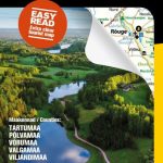
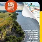
 Estonia: Regio 275K Regional Road Maps
 Estonia South-East Regio Map
 Estonia North-West Regio Map
 Estonia: Manors and Historic Country Houses Map
 Estonia North-East Regio Map
 Estonia 8
 Estonia & Tallinn ITMB
 Lonely Planet Estonia, Latvia & Lithuania
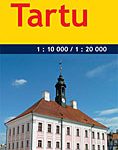
 Tartu
Tartu
 Golden Triangle Road Map – Delhi – Agra – Jaipur
 Tartu Jana Seta Street Plan WATERPROOF
 Estonia Reise Know-How
 Tallinn Jana Seta Street Plan WATERPROOF
 Saaremaa – Hiiumaa Jana Seta Map
 Bratislava – Slovakia
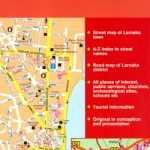 Larmaka Street Plan and District Road Map
 Kurzeme North Jana Seta Tourist Map
 DK Eyewitness Travel Guide Estonia, Latvia & Lithuania
 Latgale South Jana Seta Tourist Map
 Baltic States Regio Road Atlas
 Vidzeme North Jana Seta Tourist Map
 Finland Road Atlas GLOVEBOX, SPIRAL-BOUND
 Kurzeme South Jana Seta Tourist Map
 Central Latvia Jana Seta Tourist Map
 Estonia – Latvia – Lithuania Marco Polo Road Map
 Vidzeme East – Latgale North Jana Seta Tourist Map
 Pรคrnu Jana Seta Street Plan WATERPROOF
 Senegal & Gambia ITMB
Sri Lanka & India South ITMB
Senegal & Gambia ITMB
Sri Lanka & India South ITMB
 Ukraine Kartografija Road Atlas 500K HARDBACK
Ukraine Road Atlas (500K, Spiral-bound)
Belarus (Cyrillic edition)
Ukraine Kartografija Road Atlas 500K HARDBACK
Ukraine Road Atlas (500K, Spiral-bound)
Belarus (Cyrillic edition)