Disclosure : This site contains affiliate links to products. We may receive a commission for purchases made through these links.
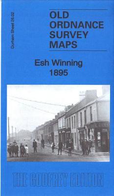
Esh Winning 1895 – 26.02

Related Products:
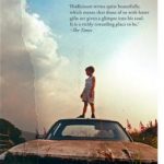
 Devil`s Day: From the Costa winning and bestselling author of The Loney
 The Waiter: the award-winning first book in a thrilling new detective series
 Retail Recovery: How Creative Retailers Are Winning in their Post-Apocalyptic World
 The Winning Eye
 The Mad Women`s Ball: The prize-winning French bestseller
 Now We Shall Be Entirely Free: The `magnificent` novel by the Costa-winning author of PURE
 Winning isn`t Luck: How to Succeed in Racing Dinghies and Yachts
 Mr Loverman: From the Booker Prize-Winning Auhtor of `Girl, Woman, Other`
 Let Us Be True: From the Betty Trask Prize-winning author of Glass
Wild About Britain: A Lifetime of Award-Winning Nature Writing
Let Us Be True: From the Betty Trask Prize-winning author of Glass
Wild About Britain: A Lifetime of Award-Winning Nature Writing
 Photographing: New York: Award-Winning Photographers Show You How to Get the Best Shots
Soul Tourists: From the Booker prize-winning author of `Girl, Woman, Other`
Photographing: New York: Award-Winning Photographers Show You How to Get the Best Shots
Soul Tourists: From the Booker prize-winning author of `Girl, Woman, Other`
 Blonde Roots: From the Booker prize-winning author of `Girl, Woman, Other`
 Manifesto: A Rallying Cry to Never Give Up from the Booker Prize-Winning Author of Girl, Woman, Other
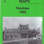 Penshaw 1895 – 13.07
 Inverkeithing 1895 – 43.02
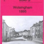 Wolsingham 1895 – 25.13
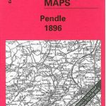 Pendle 1895 – 68
 Rossendale 1895 – 76
 Teesside 1895 – 33
 The Potteries 1895 – 123
 Ryton 1895 – 1.12
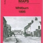 Whitburn 1895 – 4.15
 Dunfermline 1895 – 39.05
 Stanhope 1895 – 24.09
 The Living Sea of Waking Dreams: From the Booker Prize-winning author of `The Narrow Road to the Deep North`
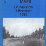 Shiney Row & Bournmoor 1895 – 13.11
 Harraton & Fatfield 1895 – 13.06
 Old Marley Hill 1895 – 6.14
 Ushaw Moor 1895 – 26.03
 Lumley Castle 1895 – 13.14
 Monkwearmouth & Southwick 1895 – 8.10
 Central Westmorland 1895 – 39
 Coniston & Ambleside 1895 – 38
 South Hylton 1895 – 7.16
 Fencehouses & New Lambton 1895 – 13.15
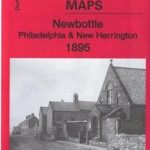 Newbottle – Philadelphia & New Herrington 1895 – 13.12
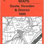 Goole – Howden & District 1895 – 79
 Derby Derwent & Erewash 1895 – 125
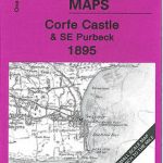 Corfe Castle & SE Purbeck 1895 – 343