Disclosure : This site contains affiliate links to products. We may receive a commission for purchases made through these links.
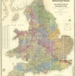
England, Wales and Southern Scotland Geological Map 1815 by William Smith
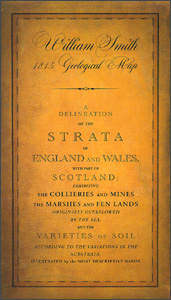
A beautiful reproduction by the British Geological Survey of William Smith’s famous 1815 geological map of England and Wales, with the combination of superb hand colouring and old-fashioned cartography providing a really stunning effect.The map, to give it its full, impressive title: ‘A delineation of the strata of England and Wales, with part of Scotland; exhibiting the collieries and mines, the marches and fen lands originally overflowed by the sea, and the varieties of soil according to the variations in the substrata, illustrated by the most descriptive names by W. Smith”, extends north beyond the Firth of Forth and the Clyde to Dundee.The base map has plenty of names of towns, villages and various topographic features, and shows the network of rivers and canals as well as roads. Symbols indicate locations of collieries, lead/copper/tin mines, and salt or aluminium works. The original map was printed in 15 parts at a scale of 1″ to five miles, and if combined would have measured eight feet high by six feet wide. It is reproduced here at approximately half its original scale.PLEASE NOTE: due to the reduction in scale names of many locations are in a very small print size, although clearly legible with a magnifying glass.


