Disclosure : This site contains affiliate links to products. We may receive a commission for purchases made through these links.
Emilia-Romagna TCI Regional 06

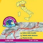
Emilia-Romagna in Touring Club Italiano’s series of regional road maps of Italy at 1:200,000, used by millions of locals and tourists alike and always among Stanford’s perennial best-sellers. Coverage extends from Cremona, Mantua and Chioggia southwards to Pisa, Florence and Urbino, and includes Bologna, Piacenza, Parma, Modena, Ferrara, La Spezia and the eastern part of the Italian Riviera, Carrara, Lucca, Pistoia, Ravenna, Cesenatico, Rimini, San Marino, etc.TCI maps have subtle but very effective relief shading plus spot heights to present the topography. Names of mountain ranges, valleys, peaks, etc. are shown and national parks and other protected areas are prominently highlighted. Road network is presented in great detail, from motorways to dirt tracks navigable only with difficulty. Minor roads are very clear and easy to read and, where necessary, are drawn without generalizing their course, showing the twists and turns across the mountainous terrain. Steep roads are annotated with three levels of gradient markings. Scenic routes are highlighted. Motorways have the usual features such as toll barriers, services, etc. Railway network shows stations and level crossings and, where appropriate, ferry routes are marked. In mountainous areas refuges, cable car lines, chair lifts, etc. are markedTowns and villages of particular interest are highlighted in three grades, with symbols indicating various monuments, castes, churches, etc. The maps have no geographical co-ordinates. On the reverse each title has an index plus a national distance table. Map legend includes English.To see the other titles in this series please click on the series link.

Related Products:
 Emilia-Romagna – Parma – Bologna – Ravenna K+F Regional Road Map 7
 Emilia-Romagna – Bologna F&B Top 10 Tips
 Emilia-Romagna
 Emilia-Romagna Michelin Local 357
 Sardinia TCI Regional 15
 Italy: Touring Club Italiano 200K Regional Road Maps
 Campania – Basilicata TCI Regional 12
 Apulia / Puglia TCI Regional 11
Piedmont – Aosta Valley TCI Regional 01
Sicily TCI Regional 14
Apulia / Puglia TCI Regional 11
Piedmont – Aosta Valley TCI Regional 01
Sicily TCI Regional 14
 Liguria TCI Regional 05
Veneto – Friuli-Venezia Giulia TCI Regional 04
Trentino – Alto Adige TCI Regional 03
Liguria TCI Regional 05
Veneto – Friuli-Venezia Giulia TCI Regional 04
Trentino – Alto Adige TCI Regional 03
 Lazio TCI Regional 10
 Blue Guide Emilia Romagna
 Emilia Romagna Guide Verdi (Italian Text Only)
 Bologna and Emilia Romagna Footprint Focus Guide
 Northern England – Midlands Michelin Regional 502
 Italy Central Michelin Regional 563
 Northern Italy: Emilia-Romagna: including Bologna, Ferrara, Modena, Parma, Ravenna and the Republic of San Marino
 Italy South Michelin Regional 564
 Italy North West Michelin Regional 561
 Saxony-Anhalt Marco Polo Regional Map 8
 Thuringia Marco Polo Regional Map 7
 Hesse Marco Polo Regional Map 6
 Mecklenburg-Vorpommern Marco Polo Regional Map 2
 Wales – South West England – Midlands Michelin Regional 503
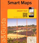 Italy: Touring Club Italiano Regional Smart Maps
 Saxony Marco Polo Regional Map 9
 Berlin – Brandenburg Marco Polo Regional Map 4
 Bavaria North Marco Polo Regional Map 12
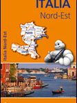 Italy North East Michelin Regional 562
 Scotland Michelin Regional 501 WATERPROOF
 Scotland Michelin Regional 501
 Bagno di Romagna Monti Editore 19
 Schleswig-Holstein – Hamburg – Bremen Marco Polo Regional Map 1
 Bavaria South Marco Polo Regional Map 13
 Rhineland-Palatinate – Saarland Marco Polo Regional Map 10
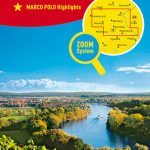
 Germany: Marco Polo 200K Regional Road Maps
 South East England – Midlands – East Anglia Michelin Regional 504