Disclosure : This site contains affiliate links to products. We may receive a commission for purchases made through these links.
Elba L`Escursionista Editore

Elba at 1:25,000 on a contoured and GPS-compatible map from L’Escursionista Editore prominently highlighting local trails and longer routes, shown where appropriate with their waymaking symbols and/or official numbers, plus a 32-page English language booklet on the Grande Traversata Elbana including accommodation.Topography of the island is presented by contours at 25m intervals with spot heights, relief shading, plus colouring for woodlands. The map shows local paths and mule tracks, indicating narrow or poorly marked trails and sections passable only when the sea is calm. Where appropriate, waymarked routes are annotated with their colours/signs and/or official numbers. Two longer routes are highlighted: the GTE ‘“ Grande Traversata Elbana through the interior and the Tour delle Coste. Also marked are locations with mountain bike trails graded according to the degree of difficulty. The map has a 1-km UTM grid. Map legend includes English.Accompanying 32-page booklet in English describes the GTE in four stages and provides contact details for accommodations and other useful numbers. A table shows locations with accommodation, restaurants, grocery shops, cash dispensers and bus stops.

Related Products:
 Cervino – Monte Rosa – Valtourenche – Valle di Champorcher L`Escursionista Editore
 Valle Maira l`Escursionista Editore
 Alte Valli di Lanzo – Val Grande – Val d`Ala – Val di Viu L`Escursionista Editore 17
 La Thuile ‘“ Piccolo San Bernardo L`Escursionista Editore 2
 Monte Bianco / Mt Blanc – Courmayeur L`Escursionista Editore 1
 Valsavarenche – Gran Paradiso L`Escursionista Editore 9
 Elba Kompass 2468
 Gran San Bernardo – Valle di Ollomont L`Escursionista Editore 5
Valle di Cogne – Gran Paradiso L`Escursionista Editore 10
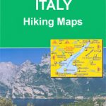
Italy: L`Escursionista Editore 25K Hiking Maps of the Italian Alps
Gran San Bernardo – Valle di Ollomont L`Escursionista Editore 5
Valle di Cogne – Gran Paradiso L`Escursionista Editore 10
Italy: L`Escursionista Editore 25K Hiking Maps of the Italian Alps
 La Thuile ‘“ Haute Tarentaise l`Escursionista Editore 01
 Monte Rosa – Ayas – Gressoney – Alagna L`Escursionista Editore 8
 Valle dell`Orco – Gran Paradiso L`Escursionista Editore 14
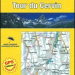 Tour of the Matterhorn / Cervino L`Escursionista Editore Map-Guide
Dora Baltea Canavesana – Valchiusella – Valle Sacra L`Escursionista Editore 16
Tour of the Matterhorn / Cervino L`Escursionista Editore Map-Guide
Dora Baltea Canavesana – Valchiusella – Valle Sacra L`Escursionista Editore 16
 Val Soana – Valle di Ribordone – Valle di Locana L`Escursionista Editore 15
Valpelline – Saint-Barthรฉlemy L`Escursionista Editore 6
Val Soana – Valle di Ribordone – Valle di Locana L`Escursionista Editore 15
Valpelline – Saint-Barthรฉlemy L`Escursionista Editore 6
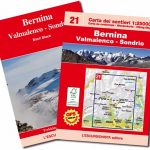 Bernina – Valmalenco – Sondrio L`Escursionista Editore 21
 Valgrisenche – Val di Rhemes – Valsavarenche L`Escursionista Editore 3
 Val di Champorcher – Mont Avic L`Escursionista Editore 11
Basse valli d`Ayas e del Lys L`Escursionista Editore 12
Val di Champorcher – Mont Avic L`Escursionista Editore 11
Basse valli d`Ayas e del Lys L`Escursionista Editore 12
 Tour du Mont Blanc L`Escursionista Editore Map-Guide
 Valtournenche – Monte Cervino / Matterhorn – Val d`Ayas West L`Escursionista Editore 7
 Italy/France/Switzerland: L`Escursionista Editore Maps of High Alpine Tours
 Tour of Saint-Bernard L`Escursionista Editore Map-Guide
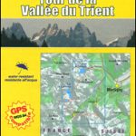 Tour of the Vallรฉe du Trient L`Escursionista Editore Map-Guide
 Conca di Aosta – Mont Emilius – Mont Fallere L`Escursionista Editore 4
 Valle Centrale – Saint-Barthรฉlemy – Saint-Marcel – Val Clavalite L`Escursionista Editore 13
 Valli di Lanzo Fraternali Editore 08
Pinerolese – Val Sangone Fraternali Editore 06
Alta Valle Susa – Bardonecchia – Oulx Fraternali Editore 01
Valli di Lanzo Fraternali Editore 08
Pinerolese – Val Sangone Fraternali Editore 06
Alta Valle Susa – Bardonecchia – Oulx Fraternali Editore 01
 Mondovรฌ – Val Ellero – Val Maudagna – Val Corsaglia – Val Casotto Fraternali Editore 22
Basse Valli di Lanzo – Alto Canavese Fraternali Editore 09
Mondovรฌ – Val Ellero – Val Maudagna – Val Corsaglia – Val Casotto Fraternali Editore 22
Basse Valli di Lanzo – Alto Canavese Fraternali Editore 09
 Alta Valle Susa – Alta Val Chisone Fraternali Editore 02
 Bagno di Romagna Monti Editore 19
Bassa Valle Susa – Musine – Val Sangone – Collina di Rivoli Fraternali Editore 04
Bagno di Romagna Monti Editore 19
Bassa Valle Susa – Musine – Val Sangone – Collina di Rivoli Fraternali Editore 04
 Foreste Casentinesi NP Monti Editore 20
Italy: Fraternali Editore Hiking Maps of Southern Italian Alps
Bassa Valle Varaita – Bassa Valle Maira Fraternali Editore 12
Foreste Casentinesi NP Monti Editore 20
Italy: Fraternali Editore Hiking Maps of Southern Italian Alps
Bassa Valle Varaita – Bassa Valle Maira Fraternali Editore 12
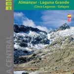 Sierra de Gredos – Almanzor – Laguna Grande Editorial Alpina