Disclosure : This site contains affiliate links to products. We may receive a commission for purchases made through these links.
Edinburgh 1926-1928
Edinburgh 1926-1928 map from Cassini reproducing old Ordnance Survey mapping of Scotland presented in a format designed to offer a convenient comparison with the present day coverage from the OS.Old maps have been combined so that the sheet lines correspond to the current Landranger series map No. 66 and are reproduced with the scale changed from one inch to one mile to 1:50,000. Cassini historical maps present the city and the surrounding area at 1:50,000 as mapped by:* Scottish First Edition 1857-1869 in black and white and with relief shown by hachuring* Scottish Third Edition 1905-1907* Scottish Popular Edition 1926-1928 with contour lines and colouring to indicate woodlands, parks, etc* OS Seventh Series 1956-1957Each map includes notes on the development of Ordnance Survey and the various series produced by them. For those interested in maps and cartography in general, the Cassini series also provides a fascinating insight into how Ordnance Survey cartographic style has developed over a period of over 100 years.Coverage on the four 1:50,000 maps is this set includes present day North Berwick, Musselburgh, Dalkeith, Penicuik, Loanhead, Carlops, Waterheads, Oxton, Temple, Fala, Gorebridge, Balerno, Pathhead, Pencaitland, Gifford, Haddington, Prestonpans, Londniddry, Drem, Gullane, Kinghorn, Butntisland and Aberdour, with Pentland Hills, Lammermuir Hills and Moorfoot Hills, Hartside Hill, Gladhouse Reservoir, Threipmuir Reservoir, the Firth of Forth, Aberlady Bay and Cramond Island.* PLEASE NOTE: Stanfords can also print on request mapping from all four series *centring the map on a location of your choice.* For more information please click on the link below.

Related Products:
 Edinburgh 1857-1869
Edinburgh 1905-1907
Edinburgh 1956-1957
Edinburgh 1857-1869
Edinburgh 1905-1907
Edinburgh 1956-1957
 Berwick-upon-Tweed 1926
Cheviot Hills and Kielder Water 1901
Minehead and Brendon Hills 1919
Malvern Link 1926
Aberystwyth and Machynlleth 1921-1923
Berwick-upon-Tweed 1926
Cheviot Hills and Kielder Water 1901
Minehead and Brendon Hills 1919
Malvern Link 1926
Aberystwyth and Machynlleth 1921-1923
 Hunmanby 1926
 Urmston 1926
Land`s End and Isles of Scilly 1900
Bromsgrove 1926
Urmston 1926
Land`s End and Isles of Scilly 1900
Bromsgrove 1926
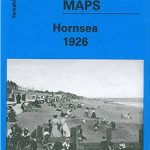 Hornsea 1926
Malvern: The Wyche 1926
Irlam Hall 1926
Lower Irlam and Cadishead 1926
Weston-super-Mare 1919-1922
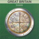
Great Britain: Cassini Historical Reproductions of Ordnance Survey One-Inch Maps of England & Wales
Bewdley 1926
Grimsby 1903-1908
Newtown and Llanidloes / Y Drenewydd a Llanidloes 1833-1837
Newtown and Llanidloes / Y Drenewydd a Llanidloes 1920-1923
Newtown and Llanidloes / Y Drenewydd a Llanidloes 1901-1903
Chelmsford 1919-1922
Eastbourne and Hastings 1898
Hexham and Haltwhistle 1863-1869
Hexham and Haltwhistle 1901-1904
Hornsea 1926
Malvern: The Wyche 1926
Irlam Hall 1926
Lower Irlam and Cadishead 1926
Weston-super-Mare 1919-1922
Great Britain: Cassini Historical Reproductions of Ordnance Survey One-Inch Maps of England & Wales
Bewdley 1926
Grimsby 1903-1908
Newtown and Llanidloes / Y Drenewydd a Llanidloes 1833-1837
Newtown and Llanidloes / Y Drenewydd a Llanidloes 1920-1923
Newtown and Llanidloes / Y Drenewydd a Llanidloes 1901-1903
Chelmsford 1919-1922
Eastbourne and Hastings 1898
Hexham and Haltwhistle 1863-1869
Hexham and Haltwhistle 1901-1904
 Ely, Haddenham and Littleport Past and Present
 Doncaster Past and Present
 Preston Past and Present
Blackburn Past and Present
Preston Past and Present
Blackburn Past and Present
 Rugby and Lutterworth Past and Present
 Redditch and Bromsgrove Past and Present
 Cannock & Rugeley Past and Present
Appleby-in-Westmorland 1925
London 1920
Anglesey / Mรดn 1922
Lleyn Peninsula / Pen Llyn 1922
Lleyn Peninsula / Pen Llyn 1903
Great Malvern East 1926
Cannock & Rugeley Past and Present
Appleby-in-Westmorland 1925
London 1920
Anglesey / Mรดn 1922
Lleyn Peninsula / Pen Llyn 1922
Lleyn Peninsula / Pen Llyn 1903
Great Malvern East 1926