Disclosure : This site contains affiliate links to products. We may receive a commission for purchases made through these links.
Eastern Graham Land BAS Geological Map 1
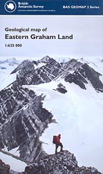
Geological map of the Eastern Graham Land, the northernmost part of the Antarctic Peninsula, at 1:625,000 from the British Antarctic Survey. Two insets show in greater detail the region around Botany Bay and around the Sobral and Longing Peninsulas. The map also includes two geological cross sections: from near Cape Legoupil to Snow Hill Islands and from Bastion Peak to Cape Framnes. Full BAS ref. number: BAS GEOMAP 2 Series, sheet 1, edition 1, published in 2011).PLEASE NOTE: to see the list of other detailed topographic and specialist maps from BAS please click on the series link. BAS maps of wider general interest are listed on our website in a separate series.


