Disclosure : This site contains affiliate links to products. We may receive a commission for purchases made through these links.
East Westphalia – Sauerland Cycling Map 11
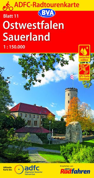
Eastern Westphalia – Sauerland: Osnabrรผck -Hannover – Kassel area of Germany in a series of waterproof and tear-resistant, GPS compatible cycling maps at 1:150,000 from the ADFC (Allgemeiner Deutscher Fahrrad-Club – the official German cycling federation), with extensive overprint for long-distance and local cycling routes. Maps in the ADFC series are contoured; the interval varies according to the type of the terrain. Steep sections are annotated with gradient markings. Colouring and/or graphics show various types of landscape: woods, vineyards, etc. An overprint highlights both the national long-distance cycling routes and the shorter local cycling trails, each clearly identified by a symbol and/or an abbreviation of its name. Sections with heavy traffic and/or poor road surface are clearly marked. Symbols indicate various facilities, such as railway stations with cycle hire, cycle repair shops, campsites, youth hostels, shelters, country restaurants/bars, sport and leisure facilities, etc. The maps have a 5-km UTM grid and each title covers an area of approx. 130 x 160km (81 x 100 miles). Map legend is in German only. Each title also provides details of online links for information about accommodation, GPS waypoints, route profiles, etc.To see all the titles in this series please click on the series link.

Related Products:
 East Westphalia Cycling Map
 Lausitz – East Erzgebirge Cycling Map 14
 East Friesland – Emsland Cycling Map 5
 Upper Bavaria East – Chiemsee – Inn Cycling Map 27
 East Frisia Cycling Map
 Germany: ADFC 150K Cycling Maps
Sauerland
Germany: ADFC 150K Cycling Maps
Sauerland
 Between the Elbe and the Weser Cycling Map 6
Holstein – Hamburg Cycling Map 2
Saarland – Moselle Cycling Map 19
Between the Elbe and the Weser Cycling Map 6
Holstein – Hamburg Cycling Map 2
Saarland – Moselle Cycling Map 19
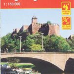
 Rhineland – Eifel Cycling Map 15
 Rhine – Neckar Cycling Map 20
Brandenburg – Spreewald Cycling Map 9
Upper Bavaria – Munich Cycling Map 26
Rhine – Neckar Cycling Map 20
Brandenburg – Spreewald Cycling Map 9
Upper Bavaria – Munich Cycling Map 26
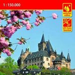 Harz – Leinetal Cycling Map 12
Thuringian Forest – Rhรถn Cycling Map 17
Luneburg Heath – Hanover Cycling Map 7
Harz – Leinetal Cycling Map 12
Thuringian Forest – Rhรถn Cycling Map 17
Luneburg Heath – Hanover Cycling Map 7
 Thuringian Forest – Rhon Cycling Map 17
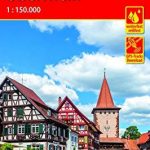
 Munsterland – Lower Rhine Cycling 10
 Franconian Alb – Altmuhltal Cycling Map 22
 Saale – West Erzgebirge Cycling Map 13
North Friesland – Schleswig Cycling Map 1
Upper Franconia – Vogtland Cycling Map 18
Havelland – Magdeburger Borde Cycling Map 8
Rugen – Usedom – Lower Pomerania Cycling Map 4
Baltic Coast – Mecklenburg Cycling Map 3
Germany: ADFC 75K/50K Regional Cycling Maps
Saale – West Erzgebirge Cycling Map 13
North Friesland – Schleswig Cycling Map 1
Upper Franconia – Vogtland Cycling Map 18
Havelland – Magdeburger Borde Cycling Map 8
Rugen – Usedom – Lower Pomerania Cycling Map 4
Baltic Coast – Mecklenburg Cycling Map 3
Germany: ADFC 75K/50K Regional Cycling Maps
 Central Franconia – Taubertal Cycling Map 21
Lake Constance – Swabian Mountains Cycling Map 25
Central Franconia – Taubertal Cycling Map 21
Lake Constance – Swabian Mountains Cycling Map 25
 Black Forest – Upper Rhine Cycling Map 24
Bavarian Forest – Danube Cycling Map 23
Rhine-Main – North Hesse Cycling Map 16
Chiemgau Cycling Map
Rhon Scenic Routes Cycling Map
Ulm and Environs Cycling Map
Black Forest – Upper Rhine Cycling Map 24
Bavarian Forest – Danube Cycling Map 23
Rhine-Main – North Hesse Cycling Map 16
Chiemgau Cycling Map
Rhon Scenic Routes Cycling Map
Ulm and Environs Cycling Map
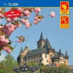 Harz Cycling Map
Saarland Cycling Map
Palatinate Cycling Map
Lahntal Cycling Map
Allgรคu Cycling Map
Harz Cycling Map
Saarland Cycling Map
Palatinate Cycling Map
Lahntal Cycling Map
Allgรคu Cycling Map