Disclosure : This site contains affiliate links to products. We may receive a commission for purchases made through these links.
East Midlands A-Z Wall Map PAPER
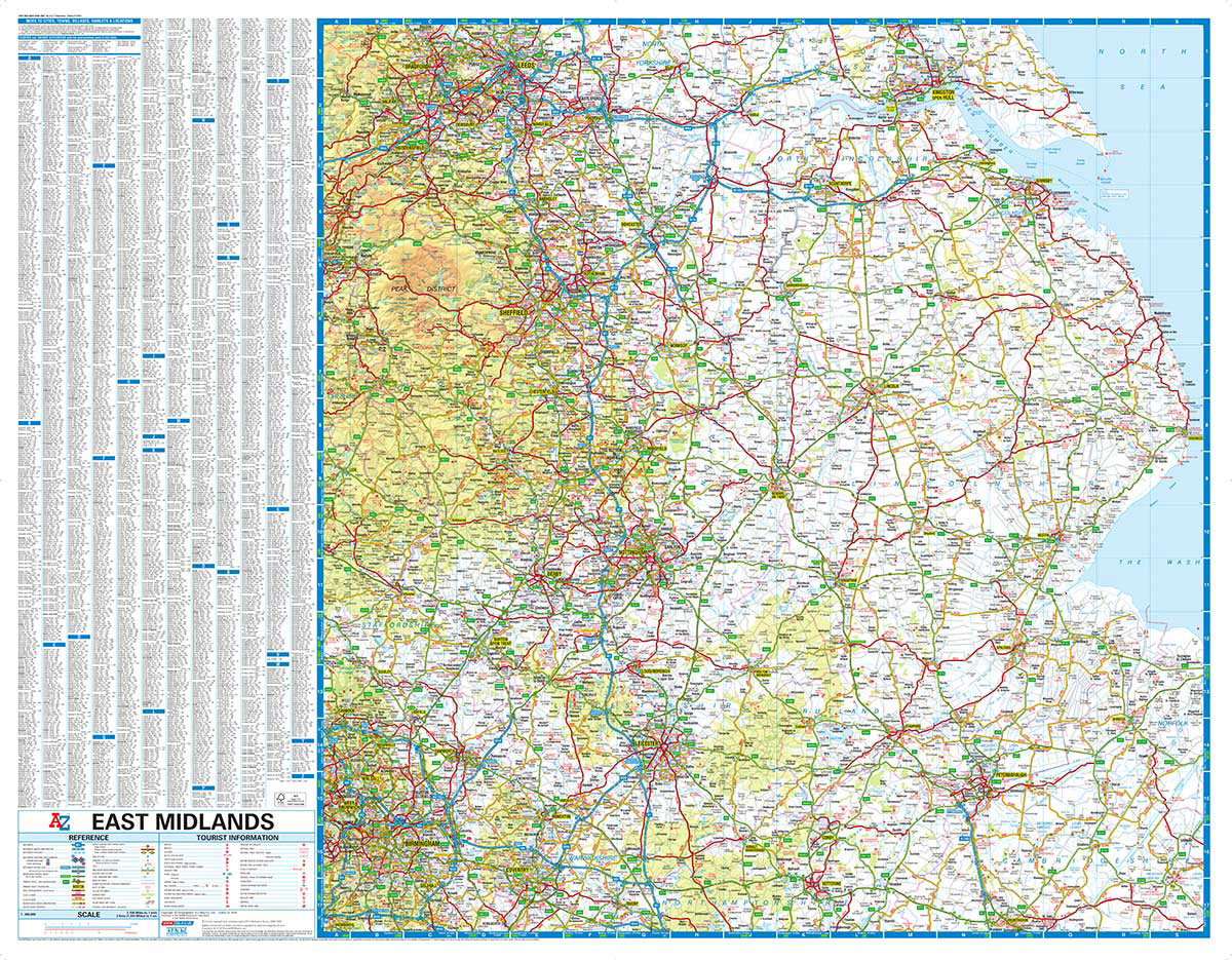
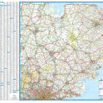
This A-Z map of the East Midlands is a full colour, single sided road map which, in addition to covering the region, extends to:BradfordLeedsKingston upon HullSkegnessBostonElyHuntingdonCoventryBirminghamBuxtonHalifaxMap detail is shown at a clear 2 kms to 1 cm (3.156 miles to 1 inch) and includes the following features:Motorways open with full junction detail, motorways under construction and proposed, service areas, primary routes and destinations, A & B roads, gradients 1:5 and steeper, tolls, mileages, national and county boundaries, together with spot heights and hill shading.Selected safety camera locations with their maximum speed limits and fuel stations.Peak District National ParkSelected places of interest, tourist information centres and golf courses.The index panel is adjacent to the map and lists cities, towns, villages, hamlets and locations.

Related Products:
 Hampshire, Dorset & Wiltshire Visitors` A-Z Wall Map PAPER
 Surrey, East & West Sussex A-Z Visitor`s Wall Map
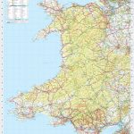 Wales A-Z Wall Map PAPER
 Northern England Regional A-Z Road Atlas
Yorkshire & Humberside A-Z Road Map
Northern England Regional A-Z Road Atlas
Yorkshire & Humberside A-Z Road Map
 Glasgow Premier A-Z Wall Map PAPER
 Lake District A-Z Visitors` Wall Map PAPER
 South East England – Midlands – East Anglia Michelin Regional 504
 Edinburgh Premier A-Z Wall Map PAPER
 Isle of Wight A-Z Visitors` Wall Map
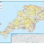
 Devon A-Z Visitors` Wall Map PAPER
British Isles Political Wall Map PAPER
Devon A-Z Visitors` Wall Map PAPER
British Isles Political Wall Map PAPER
 East Midlands A-Z Road Map
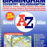 West Midlands – Birmingham – Coventry – Wolverhampton A-Z Street Atlas
 United States NGS National Parks Wall Map PAPER
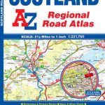 Scotland A-Z Regional Road Atlas
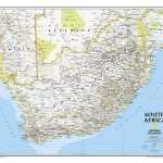 South Africa NGS Classic Wall Map PAPER
 Stanford`s Map of the County of London (1888) – A3 Wall Map, Paper
Stanford`s Map of the County of London (1888) – A2 Wall Map, Paper
Stanford`s Map of the County of London (1888) – A3 Wall Map, Paper
Stanford`s Map of the County of London (1888) – A2 Wall Map, Paper
 50 Miles Around Bristol Wall Map PAPER
 Central America NGS Classic Wall Map PAPER
 Great Britain & Ireland Michelin Wall Map PAPER
Stanford`s Map of the County of London (1888) – A1 Wall Map, Paper – Print on Demand
Great Britain & Ireland Michelin Wall Map PAPER
Stanford`s Map of the County of London (1888) – A1 Wall Map, Paper – Print on Demand
 East Anglia A-Z Wall Map
 Northern England – Midlands Michelin Regional 502
 Devon & Cornwall A-Z Wall Map PAPER
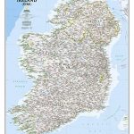 Ireland NGS Classic Wall Map PAPER
 Glasgow – Edinburgh & Central Scotland A-Z Wall Map PAPER
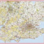 South East & Central England A-Z Wall Map PAPER
 Wales – South West England – Midlands Michelin Regional 503
East Midlands and East Anglia including London Administrative Boundary Wall Map
Wales – South West England – Midlands Michelin Regional 503
East Midlands and East Anglia including London Administrative Boundary Wall Map
 50 Miles Around Manchester A-Z Wall Map
 World Global Mapping Physical Wall Map LARGE PAPER
 Newcastle upon Tyne Premier A-Z Wall Map
 Britain and Ireland NGS Classic Wall Map PAPER
 Canada National Parks NGS Wall Map PAPER
 East Midlands & East Anglia OS Road Map 5
 Scotland North & South A-Z Wall Map PAPER
 World Global Mapping Political Wall Map X-LARGE PAPER