Disclosure : This site contains affiliate links to products. We may receive a commission for purchases made through these links.
East Barnet & Southgate 1897 – 7.09
East Barnet and Southgate in 1897 in a fascinating series of reproductions of old Ordnance Survey plans in the Alan Godfrey Editions, ideal for anyone interested in the history of their neighbourhood or family. The map covers an area from Oakleigh Road North eastward to Southgate High Street, and northward to Chelmsford Road. The village centre of Southgate is on the east side of the map, including Southgate House, several other large houses, Christ Church, and along Chase Side is Osidge. The heart of the map is rural and dominated by the Great Northern Cemetery; the GNR line runs past, partly in tunnel, with the site of the closed cemetery station. In the north-west of the map is Colney Hatch Road and St Mary`s church, East Barnet. On the reverse is half of Sheet 7.05 which continues coverage northward along Cock Fosters Road, past Oak Hill Park, to the southern fringe of Cockfosters (here Cock Fosters) with Christ Church at the top of the map. About the Alan Godfrey Editions of the 25″ OS Series:Selected towns in Great Britain and Ireland are covered by maps showing the extent of urban development in the last decades of the 19th and early 20th century. The plans have been taken from the Ordnance Survey mapping and reprinted at about 15 inches to one mile (1:4,340). On the reverse most maps have historical notes and many also include extracts from contemporary directories. Most maps cover about one mile (1.6kms) north/south, one and a half miles (2.4kms) across; adjoining sheets can be combined to provide wider coverage.FOR MORE INFORMATION AND A COMPLETE LIST OF ALL AVAILABLE TITLES PLEASE CLICK ON THE SERIES LINK.

Related Products:
 Friern Barnet and New Southgate 1898
 Barnet and Hadley 1896
New Barnet 1896
Craigendoran and Helensburgh East 1897
Carlisle North-East 1924
Barnet and Hadley 1896
New Barnet 1896
Craigendoran and Helensburgh East 1897
Carlisle North-East 1924
 North Finchley 1911
North Finchley 1894
Whetstone 1897
North Finchley 1911
North Finchley 1894
Whetstone 1897
 Swindon South-East 1899
Great Malvern East 1926
Swindon South-East 1899
Great Malvern East 1926
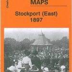 Stockport East 1897
East Jarrow 1913
Colwyn Bay South East 1911
Willenhall North East 1885
Bangor East 1901
Stockport East 1897
East Jarrow 1913
Colwyn Bay South East 1911
Willenhall North East 1885
Bangor East 1901
 Hull North East 1908
Leeds Central and North East 1890
Motherwell (East) 1897 – 12.14
Worcester North-East 1902
Hull North East 1908
Leeds Central and North East 1890
Motherwell (East) 1897 – 12.14
Worcester North-East 1902
 East Finchley 1894 – 10.2
 Bromley Common and North-East Hayes 1895
Port Sunlight and Bebington 1897
East Ham & Barking 1915 – 44.3
Bromley Common and North-East Hayes 1895
Port Sunlight and Bebington 1897
East Ham & Barking 1915 – 44.3
 North London Three Borough Challenge Walk – Enfield, Barnet and Haringey
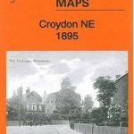 Croydon North-East 1895
Hampton Court & East Molesey 1912 – 12.13
Croydon North-East 1895
Hampton Court & East Molesey 1912 – 12.13
 Croydon NW 1895 – 154
Attercliffe 1903 – 295.01a
Croydon NW 1895 – 154
Attercliffe 1903 – 295.01a
 East Dulwich & Peckham Rye 1914 – 117.3
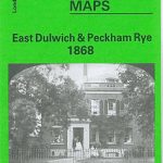 East Dulwich & Peckham Rye 1868 – 117.1
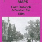 East Dulwich & Peckham Rye 1894 – 117.2
 Buxton 1897 – 15.13
Manchester South-East 1915
Barnsley South East 1904
Barnard Castle 1897 – 52.04a
East Finchley & Hampstead Garden Suburb 1894-1911 – 10.3
Buxton 1897 – 15.13
Manchester South-East 1915
Barnsley South East 1904
Barnard Castle 1897 – 52.04a
East Finchley & Hampstead Garden Suburb 1894-1911 – 10.3
 Croydon East: Coombe Park & Addiscombe Road 1895 – 158
 Leeds East 1906
Belfast (East) 1902 – 4.11
Leeds East 1906
Belfast (East) 1902 – 4.11
 Northwich North East 1908