Disclosure : This site contains affiliate links to products. We may receive a commission for purchases made through these links.
Dzukija National Park
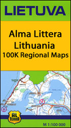
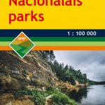
Dzukija National Park at 1:100,000 in a series GPS compatible regional maps of Lithuania from Alma Littera prominently highlighting each area’s best sights and showing a wide range of other places of interest including campsites. Main roads are graded according to the speed limit; regional and local roads indicate asphalted or gravel routes. Driving distances are marked on main and selected regional routes, and locations of petrol stations and border crossings are marked. Railway lines are shown with stations. Important sights are prominently highlighted and a very wide range of symbols indicate various places of interest, including campsites, historical and industrial heritage, archaeological and natural sites, etc.The maps also indicate hiking, cycling and kayaking routes. Topography is shown by contours and spot heights, plus colouring and/or graphics for different types of the terrain and vegetation, e.g. swamps, peat bog, orchards, forests, etc. The maps have latitude and longitude lines at 5’ and 10’ respectively. Map legend includes English.Each title comes with a booklet attached to the map cover providing descriptions of places of interest, but the text here is in Lithuanian only.

Related Products:
 ลฝemaitija National Park
Aukลกtaitijos National Park
Curonian Spit National Park
Anyksciai Regional Park Tourist Map
Grazute – Sartai Regional Parks Tourist Map
Kaunas and Environs
Panemuniu – Dubysa – Rambynas Regional Parks
Lithuania: Alma Littera 100K Regional Maps
ลฝemaitija National Park
Aukลกtaitijos National Park
Curonian Spit National Park
Anyksciai Regional Park Tourist Map
Grazute – Sartai Regional Parks Tourist Map
Kaunas and Environs
Panemuniu – Dubysa – Rambynas Regional Parks
Lithuania: Alma Littera 100K Regional Maps
 Dzukija National Park East
Dzukija I National Park West
Dzukija National Park East
Dzukija I National Park West
 Belgian Ardennes: Malmedy – Hautes Fanges National Park
Aukstaitija National Park
Belgian Ardennes: Malmedy – Hautes Fanges National Park
Aukstaitija National Park
 Triglav National Park Kartografija WATERPROOF Hiking Map
 France: IGN 200/250K Regional Maps
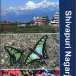 Shivapuri Nagarjun National Park
Zemaitija National Park
Shivapuri Nagarjun National Park
Zemaitija National Park
 Picos de Europa National Park 3-Map and Guide Set CNIG ENGLISH
 Picos de Europa National Park 3-Map and Guide Set CNIG SPANISH
 Sierra de Guadarrama National Park 4-Map and Guide Set CNIG
 Kampinoski National Park
 Richtersveld National Park and Northern Namaqualand
 Bavarian Forest National Park – Nature Park East UK50-29
 Estonia: Regio 275K Regional Road Maps
 Languedoc-Roussillon
 Gaujas National Park
 Gran Canaria F&B
 Khumbu – Sagarmatha National Park
 Salzburg State F&B Top 10 Tips
 Great Britain: Ordnance Survey Tour Maps
Lake Constance F&B Leisure & Panorama
Great Britain: Ordnance Survey Tour Maps
Lake Constance F&B Leisure & Panorama
 Tyrol F&B Top 10 Tips
 France: AA Regional Touring Maps
 Carinthia F&B Top 10 Tips
 Spain: Mairdumont 300K Regional Road Maps
 Bohemian Forest – Sumava National Park 2-Map Set Kompass 2000
 Burgenland F&B Top 10 Tips
Mazowiecki Regional Park
Burgenland F&B Top 10 Tips
Mazowiecki Regional Park
 Styria F&B Top 10 Tips
 Eifel National Park – Ahrtal K+F Outdoor Map 19
 Albania F&B Top 10 Tips