Disclosure : This site contains affiliate links to products. We may receive a commission for purchases made through these links.
Dunston 1894

Dunston in 1894 in a fascinating series of reproductions of old Ordnance Survey plans in the Alan Godfrey Editions, ideal for anyone interested in the history of their neighbourhood or family. The town on the eastern side of the maps and coverages stretches west to include Whickham Hall and Dockendale Hall. Features include Dunston Lodge, Dunston Hill, Norwood Brick Works, Norwood Colliery (disused), Christ Church, Drury Buildings, Dunston Colliery and St Omers Haugh. The NER Line runs through the right of the map, showing Dunston Junction. On the reverse is an extract from the 1758 map of Dunston, and part of Tyneside Sheet 17, showing Dunston Riverfront in 1894. Also included is an extract from Wards directory of 1893-4.About the Alan Godfrey Editions of the 25″ OS Series:Selected towns in Great Britain and Ireland are covered by maps showing the extent of urban development in the last decades of the 19th and early 20th century. The plans have been taken from the Ordnance Survey mapping and reprinted at about 15 inches to one mile (1:4,340). On the reverse most maps have historical notes and many also include extracts from contemporary directories. Most maps cover about one mile (1.6kms) north/south, one and a half miles (2.4kms) across; adjoining sheets can be combined to provide wider coverage.FOR MORE INFORMATION AND A COMPLETE LIST OF ALL AVAILABLE TITLES PLEASE CLICK ON THE SERIES LINK.

Related Products:
 Felling 1894
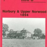 Norbury and Upper Norwood 1894
North Shields and Chirton 1894
Seaton Carew 1894
Norbury and Upper Norwood 1894
North Shields and Chirton 1894
Seaton Carew 1894
 Upper Edmonton 1894 – 3a
Central Newcastle 1894 – 11a
Upper Edmonton 1894 – 3a
Central Newcastle 1894 – 11a
 Shortlands 1894
 Ilford 1894
 Crystal Palace, Anerley and Upper Norwood 1894 – 145
 Eltham Green 1894 – 120.2
 Beckenham & Penge 1894 – 146
West Norwood 1894 – 136.2
Wakefield West 1905
Beckenham & Penge 1894 – 146
West Norwood 1894 – 136.2
Wakefield West 1905
 Greenford 1894
Old St Pancras 1871-1894
Greenford 1894
Old St Pancras 1871-1894
 Kensington 1894 – 74.2
 Beckenham South 1894
Charing Cross 1871-1894
Elswick 1913
Beckenham South 1894
Charing Cross 1871-1894
Elswick 1913
 Perivale 1894
 Yeading 1894
 Wood Green 1894 – 7.2
 Tottenham (North) 1894 – 8a
West Twickenham & Strawberry Hill 1894 – 121a
Tottenham (North) 1894 – 8a
West Twickenham & Strawberry Hill 1894 – 121a
 East Finchley 1894 – 10.2
 Southall 1894
 Highbury & Islington 1894 – 39.2
Sandwell Hall 1902
Durham City East 1894
Highbury & Islington 1894 – 39.2
Sandwell Hall 1902
Durham City East 1894
 New Cross & Deptford Broadway 1894 – 104.2
 Castle Douglas 1894
Sacriston 1897
Castle Douglas 1894
Sacriston 1897
 Putney & NW Wandsworth 1894 – 113.2
 Isleworth 1894
Govan 1894
Isleworth 1894
Govan 1894
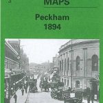 Peckham 1894 – 103.2
Teddington & Hampton Hill 1894 – 131.2
Peckham 1894 – 103.2
Teddington & Hampton Hill 1894 – 131.2
 South Norwood 1895
North Kirkcaldy & Dysart 1894 – 36.05
South Norwood 1895
North Kirkcaldy & Dysart 1894 – 36.05
 Upper Sydenham 1894 – 137.2