Disclosure : This site contains affiliate links to products. We may receive a commission for purchases made through these links.
Dundee West 1901

Dundee West in 1901 in a fascinating series of reproductions of old Ordnance Survey plans in the Alan Godfrey Editions, ideal for anyone interested in the history of their neighbourhood or family. The map covers the western part of Dundee, stretching from Seagate and William Street westward to City Road, and from Ward Road northward to Loons Street and the football grounds. Features include tramways, Royal Infirmary, Lawside Works, Caldrum Works, Angus Jute Works, Bowbridge Works, High School, The Houff, Rockwell Works, Prison, Sheriff Court Buildings, Dundee Linen Works, Sixth Ward area, Seventh Ward area, Dudhope Castle, Dundee Law, Dudhope House, Dudhope Park, Stirling Park Allotment Gardens, football ground, Albert Institute, Constable Works, Rashiewell Works, etc. On the reverse are street directory entries for City Road, Dens Road, Hill Street, Lochee Road, Murraygate and Panmure Street.About the Alan Godfrey Editions of the 25″ OS Series:Selected towns in Great Britain and Ireland are covered by maps showing the extent of urban development in the last decades of the 19th and early 20th century. The plans have been taken from the Ordnance Survey mapping and reprinted at about 15 inches to one mile (1:4,340). On the reverse most maps have historical notes and many also include extracts from contemporary directories. Most maps cover about one mile (1.6kms) north/south, one and a half miles (2.4kms) across; adjoining sheets can be combined to provide wider coverage.FOR MORE INFORMATION AND A COMPLETE LIST OF ALL AVAILABLE TITLES PLEASE CLICK ON THE SERIES LINK.

Related Products:
 Dundee East 1901
 Wolverhampton North West 1901
Bangor West 1901
Wolverhampton North West 1901
Bangor West 1901
 Walsall (SE) 1901 – 63.11
Rutherglen West and Polmadie 1910
Smethwick 1901 – 72.03a
Walsall (SE) 1901 – 63.11
Rutherglen West and Polmadie 1910
Smethwick 1901 – 72.03a
 Walsall (SW) & Pleck 1901 – 63.10a
Carlisle South-West 1924
Leicester North West 1902
Trafford Park South 1937
Walsall (SW) & Pleck 1901 – 63.10a
Carlisle South-West 1924
Leicester North West 1902
Trafford Park South 1937
 Rochdale West 1908
Blackburn West 1929
Loughborough 1901
Halesowen (West) 1901 – 4.16
Manchester North West and Central Salford 1915
Rochdale West 1908
Blackburn West 1929
Loughborough 1901
Halesowen (West) 1901 – 4.16
Manchester North West and Central Salford 1915
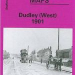 Dudley West 1901
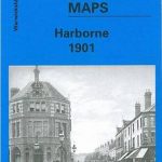 Harborne 1901
Sheffield Ecclesall Road and Sharrow 1903
Harborne 1901
Sheffield Ecclesall Road and Sharrow 1903
 Central Middlesbrough 1913 – 6.14b
Darlaston & King`s Hill 1901
Leicester South West 1902-1911
Harborne South 1901
Horsehay and Dawley 1901
Inverness West 1903
Central Middlesbrough 1913 – 6.14b
Darlaston & King`s Hill 1901
Leicester South West 1902-1911
Harborne South 1901
Horsehay and Dawley 1901
Inverness West 1903
 Wolverhampton (SE) 1901 – 62.11b
Swinton 1901
Wolverhampton (SE) 1901 – 62.11b
Swinton 1901
 West Streatham & Tooting 1894 – 135a
Newtownards 1901
West Streatham & Tooting 1894 – 135a
Newtownards 1901
 Cambridge (North) 1901 – 40.14
Sheffield Park 1903
Mexborough 1901
Bangor East 1901
Wath upon Dearne 1901
Luton 1922 – 33.05
Shire Oak and Catshill 1901
West Bromwich 1902 – 68.10b
Harton 1895
Wolverhampton (SW) 1901 – 62.10
Wollaston 1901 – 4.09
Ely 1901 – 26.14
Cambridge (North) 1901 – 40.14
Sheffield Park 1903
Mexborough 1901
Bangor East 1901
Wath upon Dearne 1901
Luton 1922 – 33.05
Shire Oak and Catshill 1901
West Bromwich 1902 – 68.10b
Harton 1895
Wolverhampton (SW) 1901 – 62.10
Wollaston 1901 – 4.09
Ely 1901 – 26.14